


Historical Jackson Hole, WY map reimagined with modern cartographic techniques. Beautifully showcases the area’s rugged topography.
$39.00 – $89.00Price range: $39.00 through $89.00
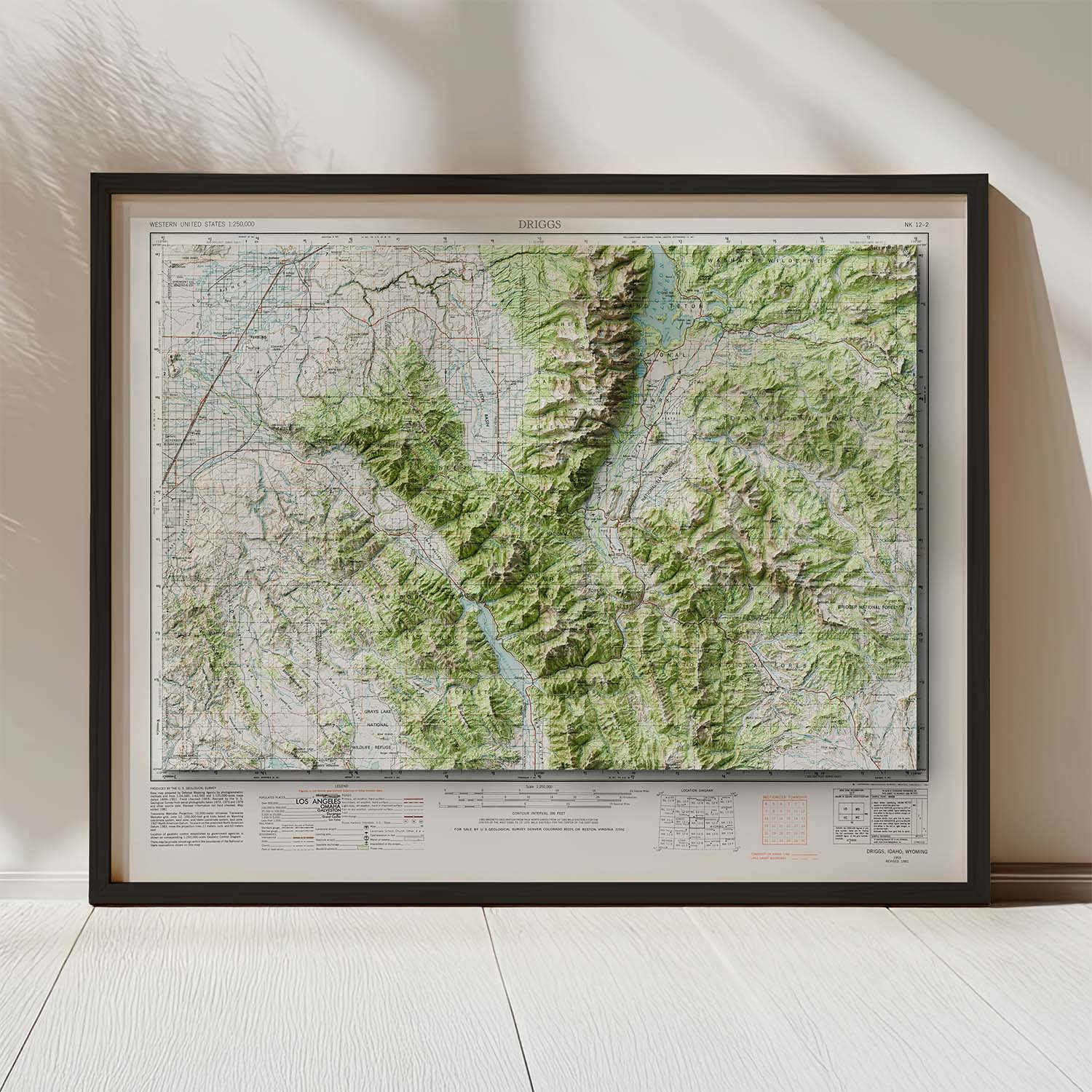
This historical Jackson Hole WY map was originally published by the United States Geological Survey in 1955. Also showing Driggs, ID and the Teton Valley, this map covers the rugged Tetons and Gros Ventre ranges. Each of our historical USGS reproductions are meticulously restored with modern cartographic techniques. Utilizing high-resolution elevation data and 3D modeling, this historical Jackson Hole, WY map has been reimagined, adding clarity and a sense of depth to the landscape. Each reproduction is printed on archival-quality premium photo paper for unparalleled detail and lasting durability.
Bring the rugged terrain of Driggs, ID and Jackson, WY into your home with this unique Jackson Hole WY map!
Framed option: black woodgrain, plexiglass front, hanging hardware included
Features & Benefits
We also offer an original map focused on the peaks surrounding the Teton Valley. Check it out here: Teton Valley Map!
We use cookies to improve your experience on our site. By using our site, you consent to cookies.
Manage your cookie preferences below:
Essential cookies enable basic functions and are necessary for the proper function of the website.
These cookies are needed for adding comments on this website.
Statistics cookies collect information anonymously. This information helps us understand how visitors use our website.
Google Analytics is a powerful tool that tracks and analyzes website traffic for informed marketing decisions.
Service URL: policies.google.com (opens in a new window)
SourceBuster is used by WooCommerce for order attribution based on user source.