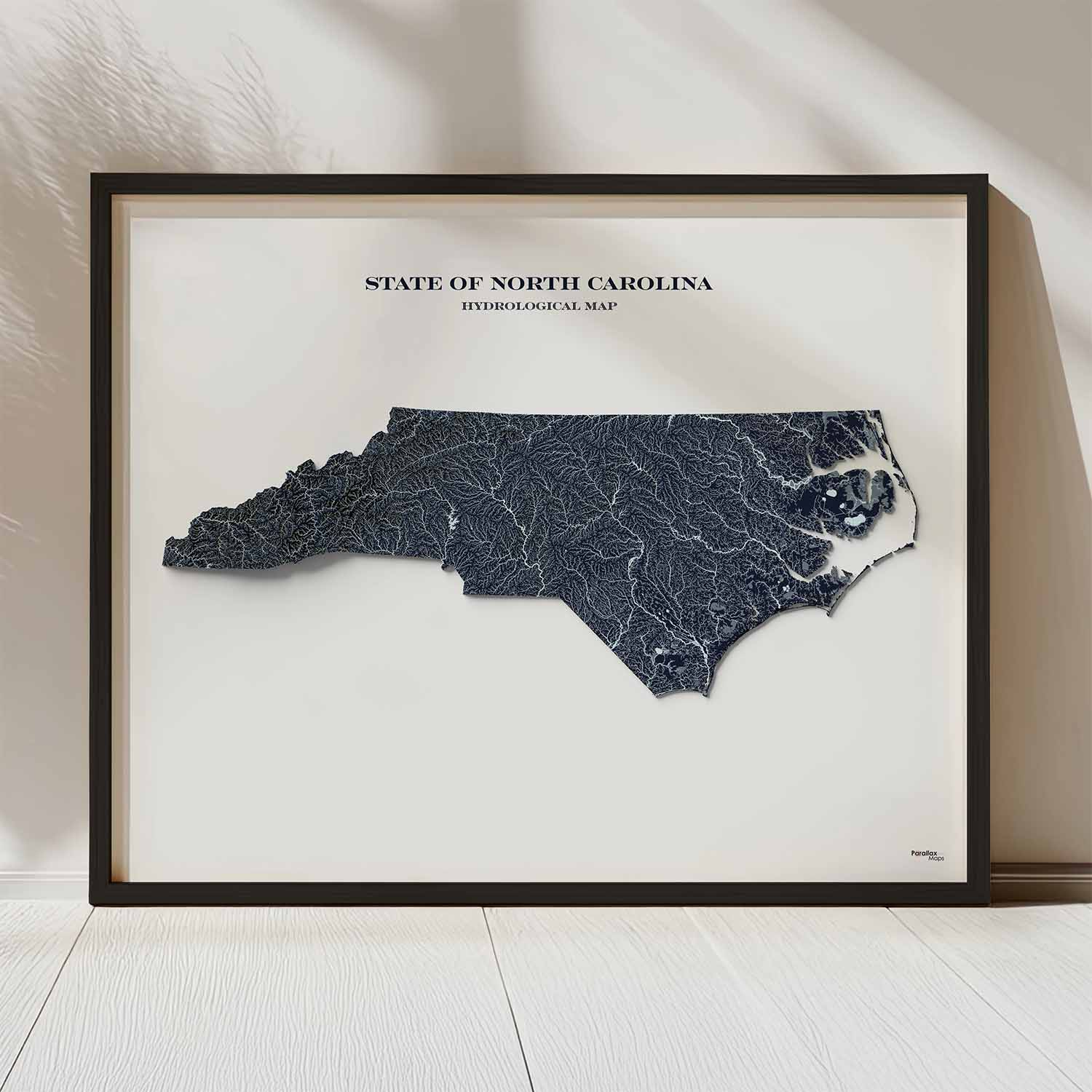
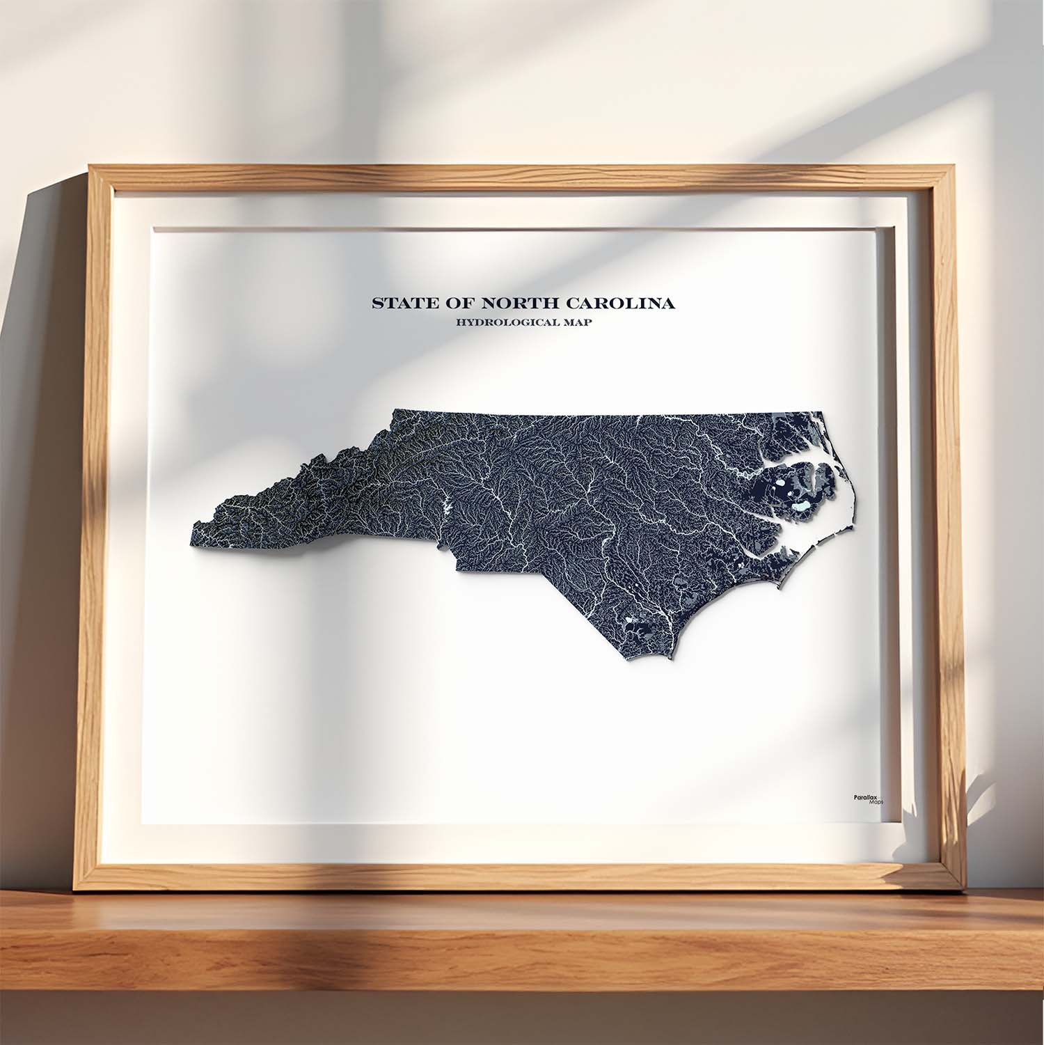
Explore the rivers, lakes, and streams of North Carolina with this detailed hydrology map. Features stunning high-resolution terrain shading and a minimalist design.
$25.00 – $159.00Price range: $25.00 through $159.00
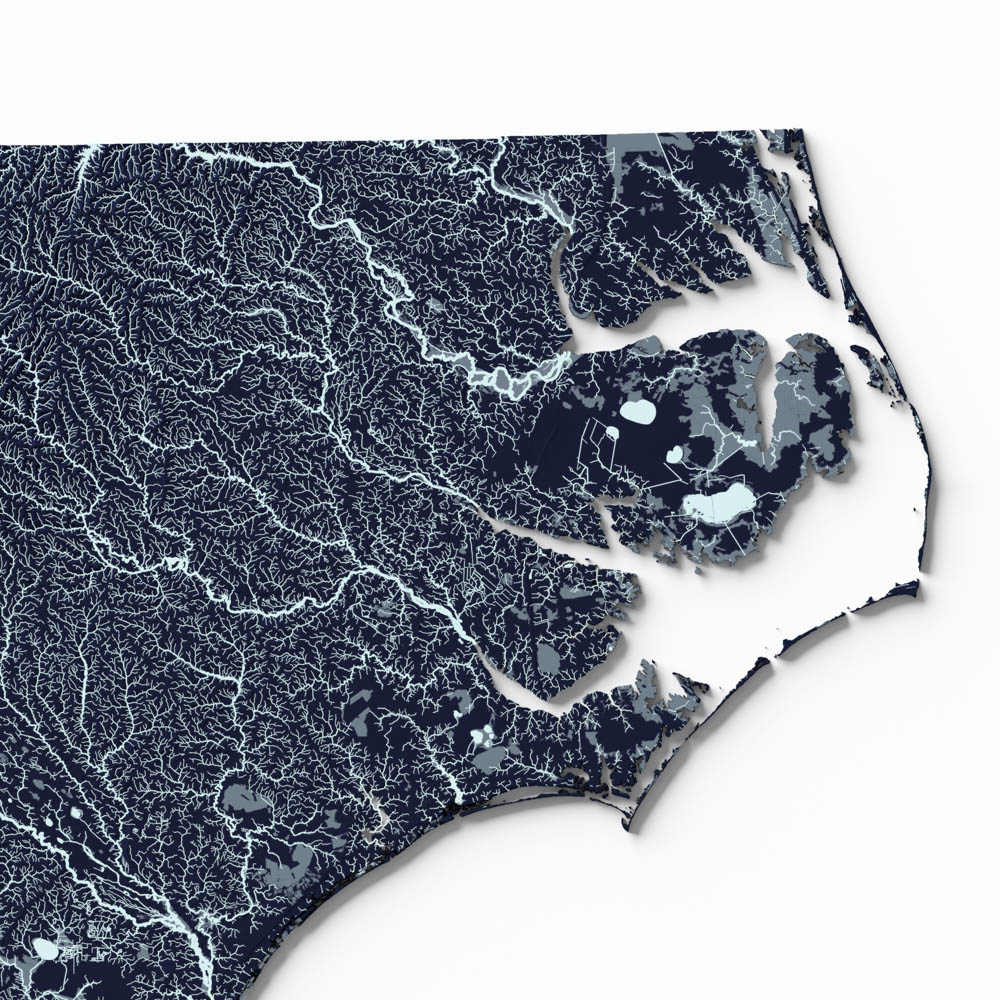
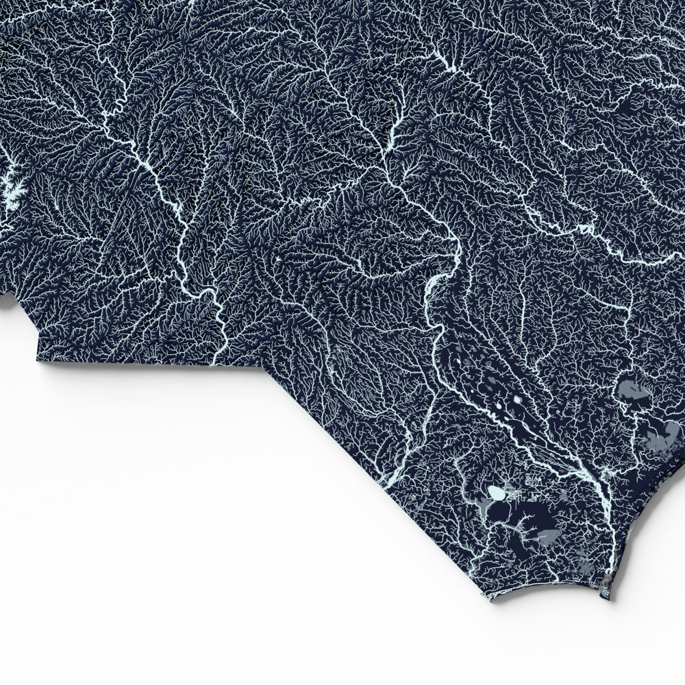
Discover North Carolina’s intricate surface water systems with this North Carolina Hydrological Map! A visually striking cartographic print that highlights rivers, lakes, and streams across North Carolina in stunning detail. Featuring high resolution terrain and streams symbolized by Total Drainage Area, this map transforms complex hydrological data into an elegant work of art.
Printed on premium photo paper with giclée inks, this North Carolina hydrological map offers exceptional color accuracy, sharp linework, and long-lasting quality. Whether you’re a geographer, hydrologist, educator, or simply a lover of beautiful maps, this piece makes a meaningful addition to any home, office, or classroom.
Framed option: black woodgrain, plexiglass front, hanging hardware included
Key Features & Benefits
Vibrant Colors
Educational & Decorative
Made in the USA: Designed and printed in Colorado
*Hydrological data derived from the USGS National Hydrography Dataset
We use cookies to improve your experience on our site. By using our site, you consent to cookies.
Manage your cookie preferences below:
Essential cookies enable basic functions and are necessary for the proper function of the website.
These cookies are needed for adding comments on this website.
Statistics cookies collect information anonymously. This information helps us understand how visitors use our website.
Google Analytics is a powerful tool that tracks and analyzes website traffic for informed marketing decisions.
Service URL: policies.google.com (opens in a new window)
SourceBuster is used by WooCommerce for order attribution based on user source.