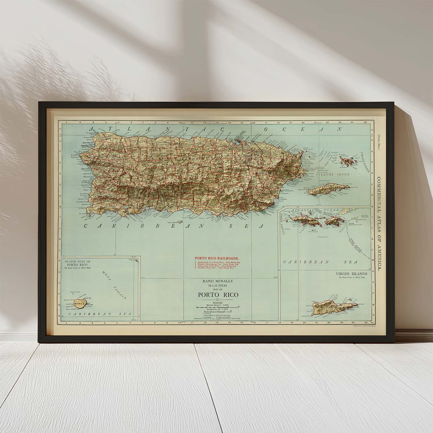
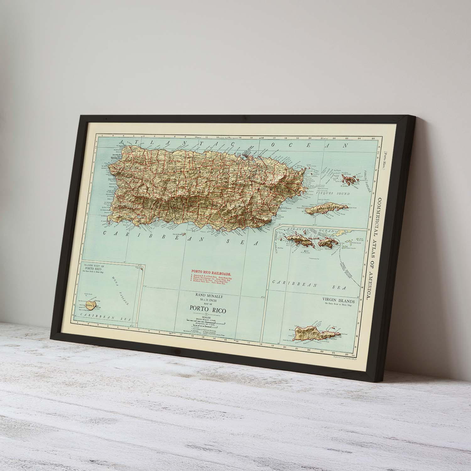
Beautifully restored Puerto Rico Vintage Map print – enhanced with modern high-resolution terrain shading.
$39.00 – $159.00Price range: $39.00 through $159.00
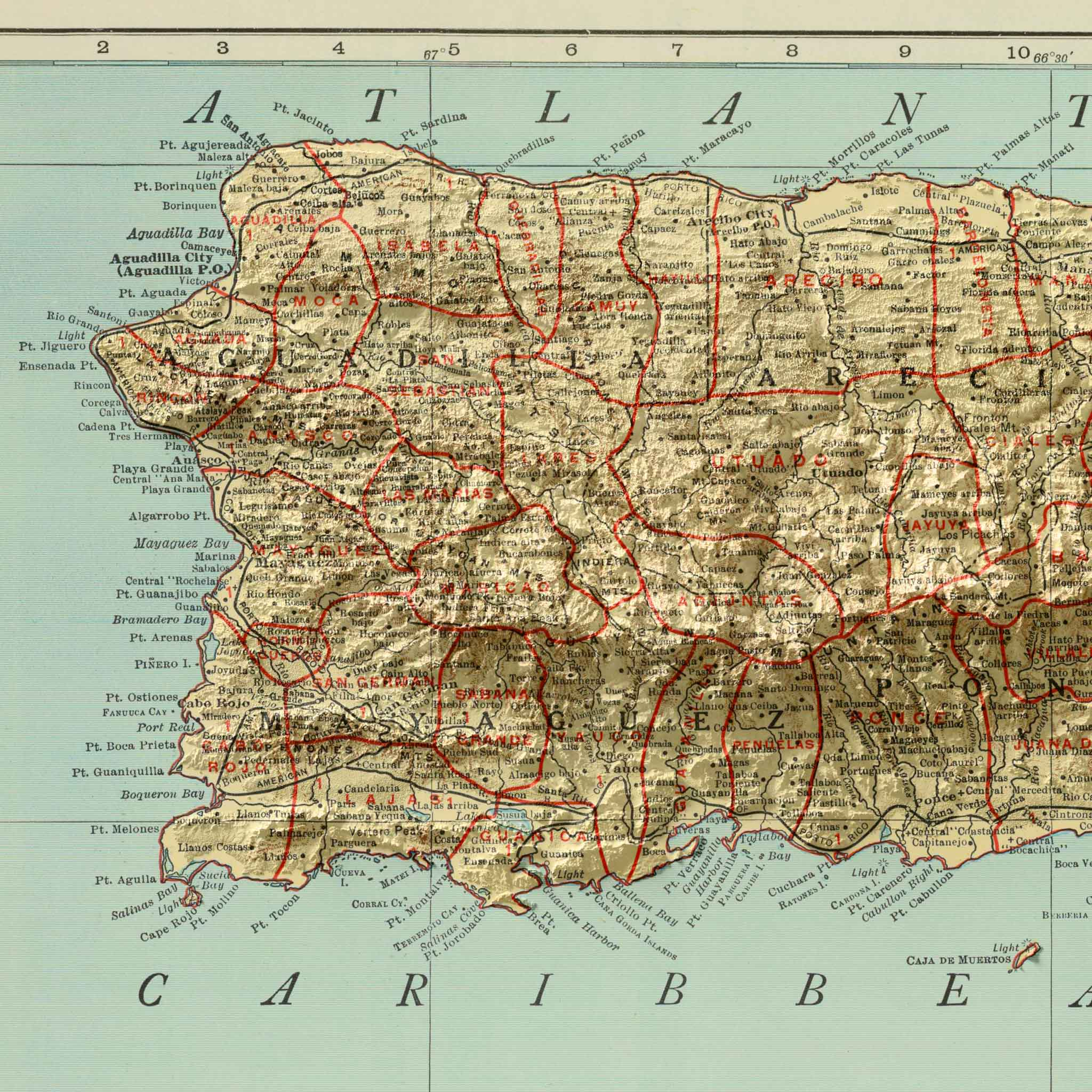
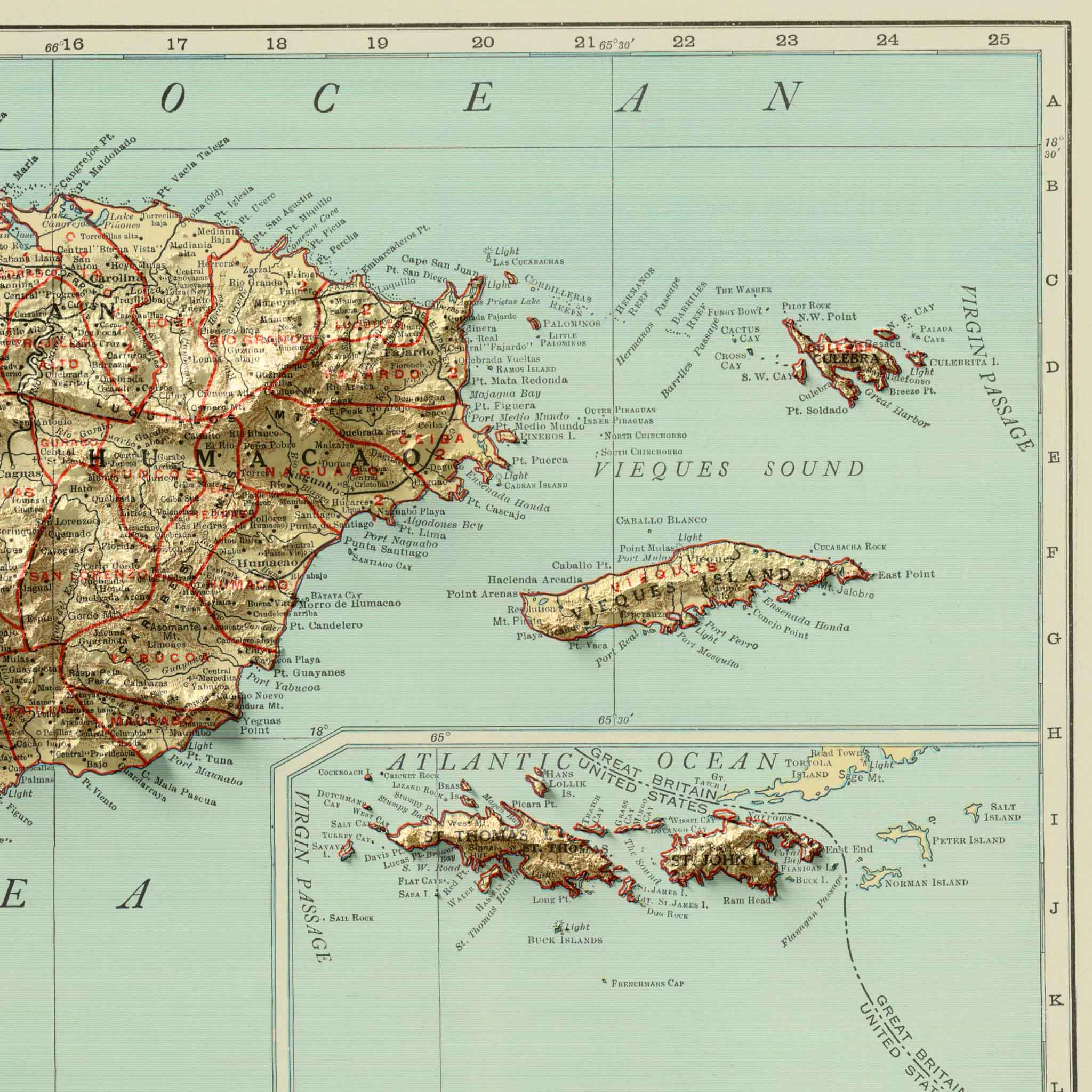
Explore the unique geography of Puerto Rico with this meticulously restored Puerto Rico Vintage Map print. Based on a 1924 Rand McNally atlas map, this Puerto Rico vintage map has been carefully enhanced using modern high-resolution elevation data and advanced 3D terrain modeling techniques.
The result is a beautifully detailed shaded relief map that adds clarity, depth, and topographic realism—while preserving the authenticity of the original cartography. Though it appears 3D, this is a flat print designed to give the impression of terrain lifting off the page.
Printed on archival-quality fine art paper using vibrant giclée inks, this Puerto Rico topographic map offers exceptional sharpness, rich tonal contrast, and lasting durability. Whether displayed in a home office, living room, studio, or workspace, it serves as both a conversation piece and a timeless tribute to the island’s mountainous landscapes and coastal contours.
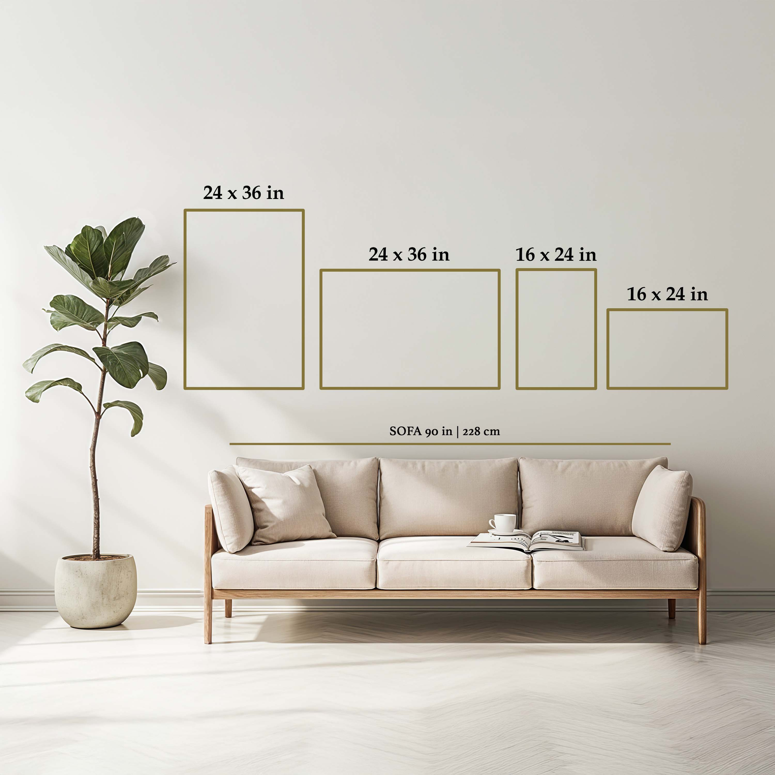
Framed or Print-Only Options: Choose a ready-to-hang framed version or a standalone fine art print.
Key Features & Benefits
Made in the USA: Proudly designed and printed in the United States
Framed Option: black woodgrain, plexiglass front, hanging hardware included for easy installation
We use cookies to improve your experience on our site. By using our site, you consent to cookies.
Manage your cookie preferences below:
Essential cookies enable basic functions and are necessary for the proper function of the website.
These cookies are needed for adding comments on this website.
Statistics cookies collect information anonymously. This information helps us understand how visitors use our website.
Google Analytics is a powerful tool that tracks and analyzes website traffic for informed marketing decisions.
Service URL: policies.google.com (opens in a new window)
SourceBuster is used by WooCommerce for order attribution based on user source.