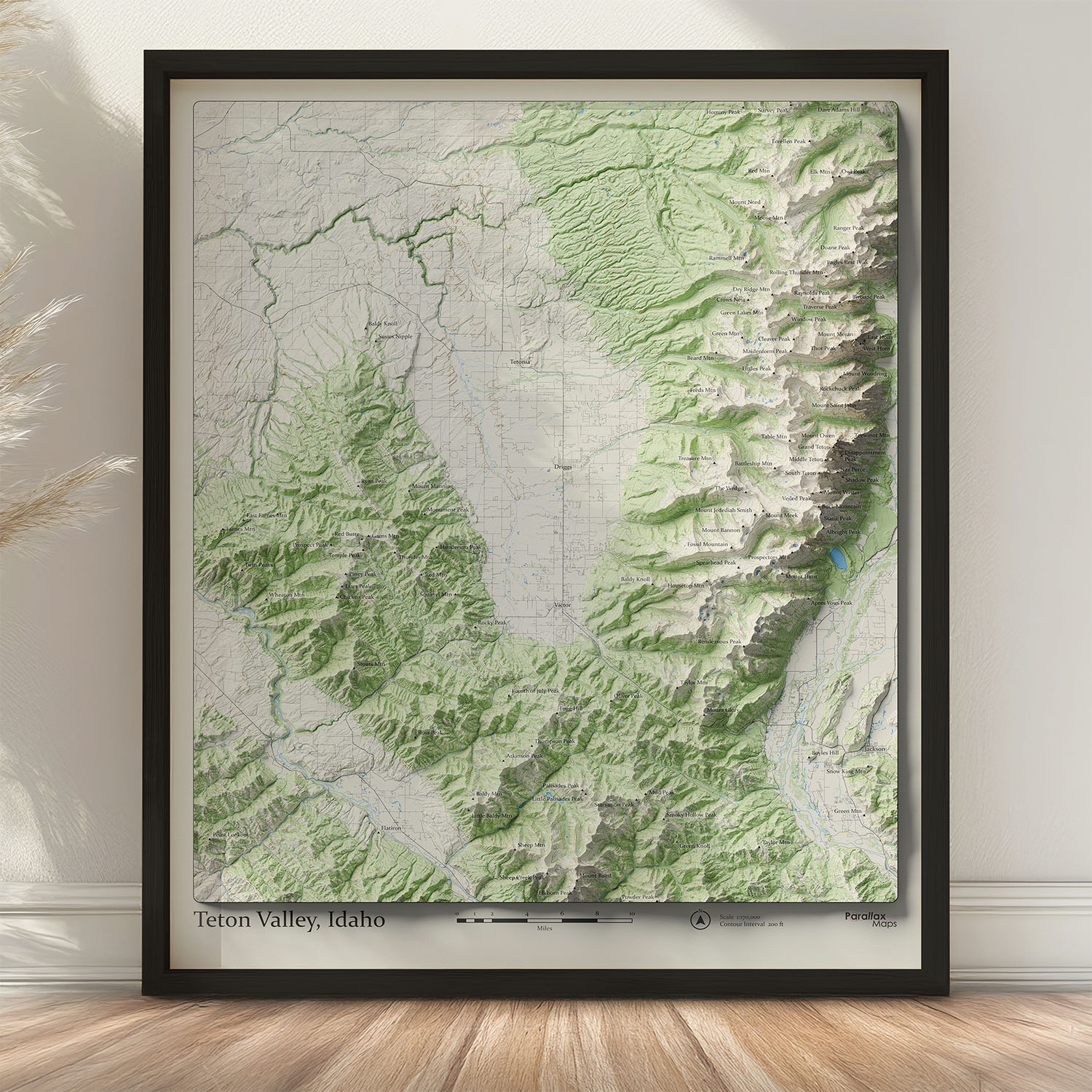
Eye-catching wall map detailing the mountain peaks around Teton Valley in Idaho
$39.00 – $89.00Price range: $39.00 through $89.00
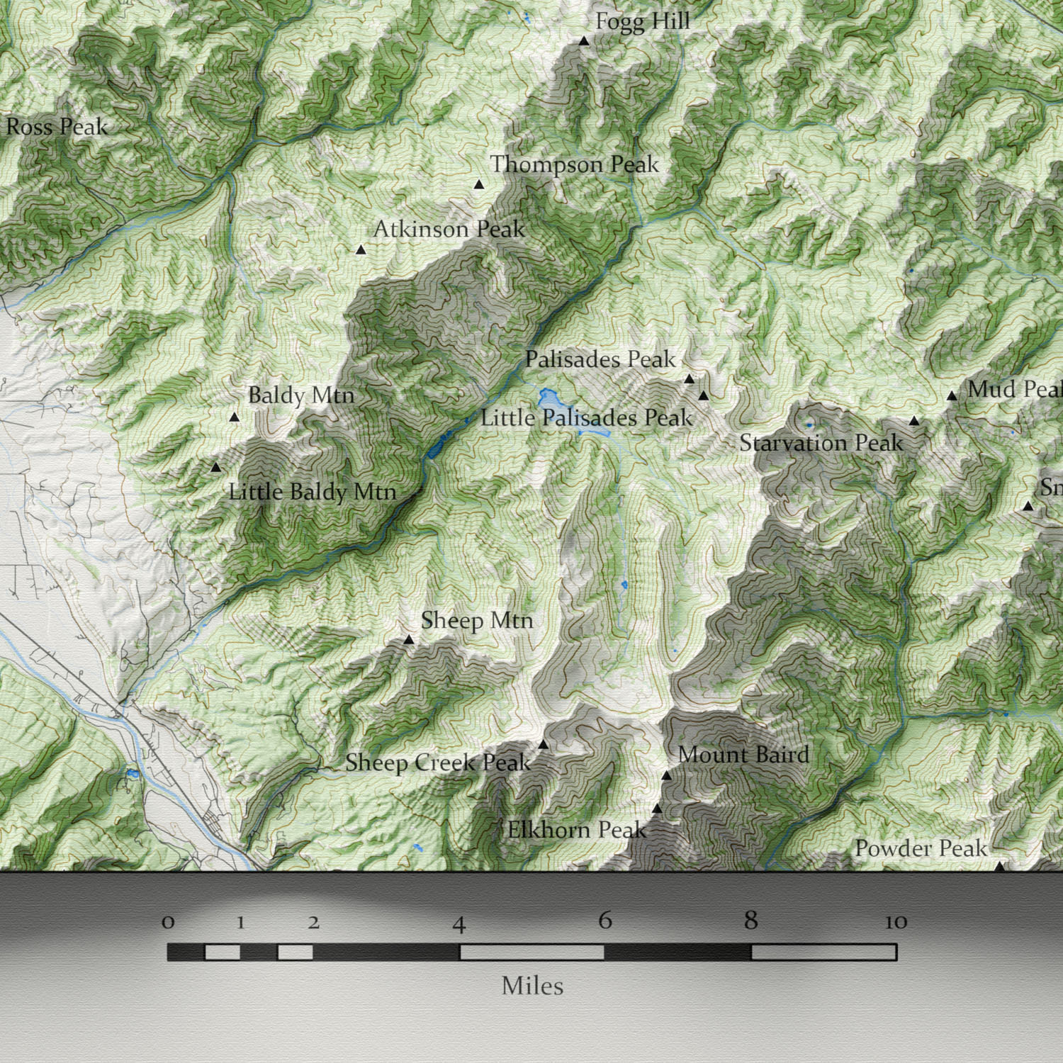
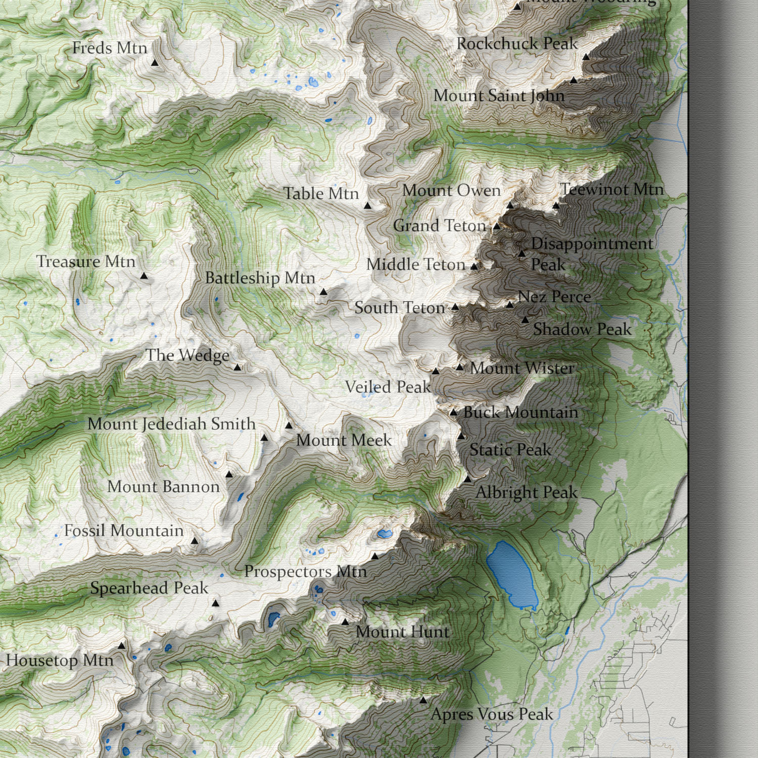
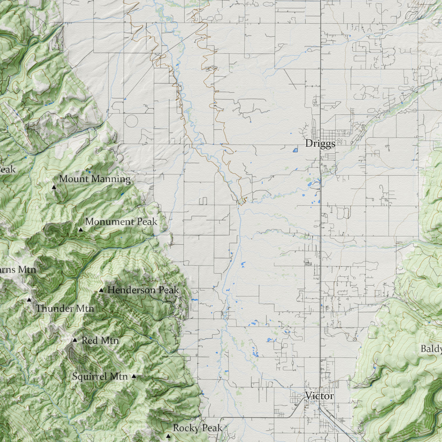
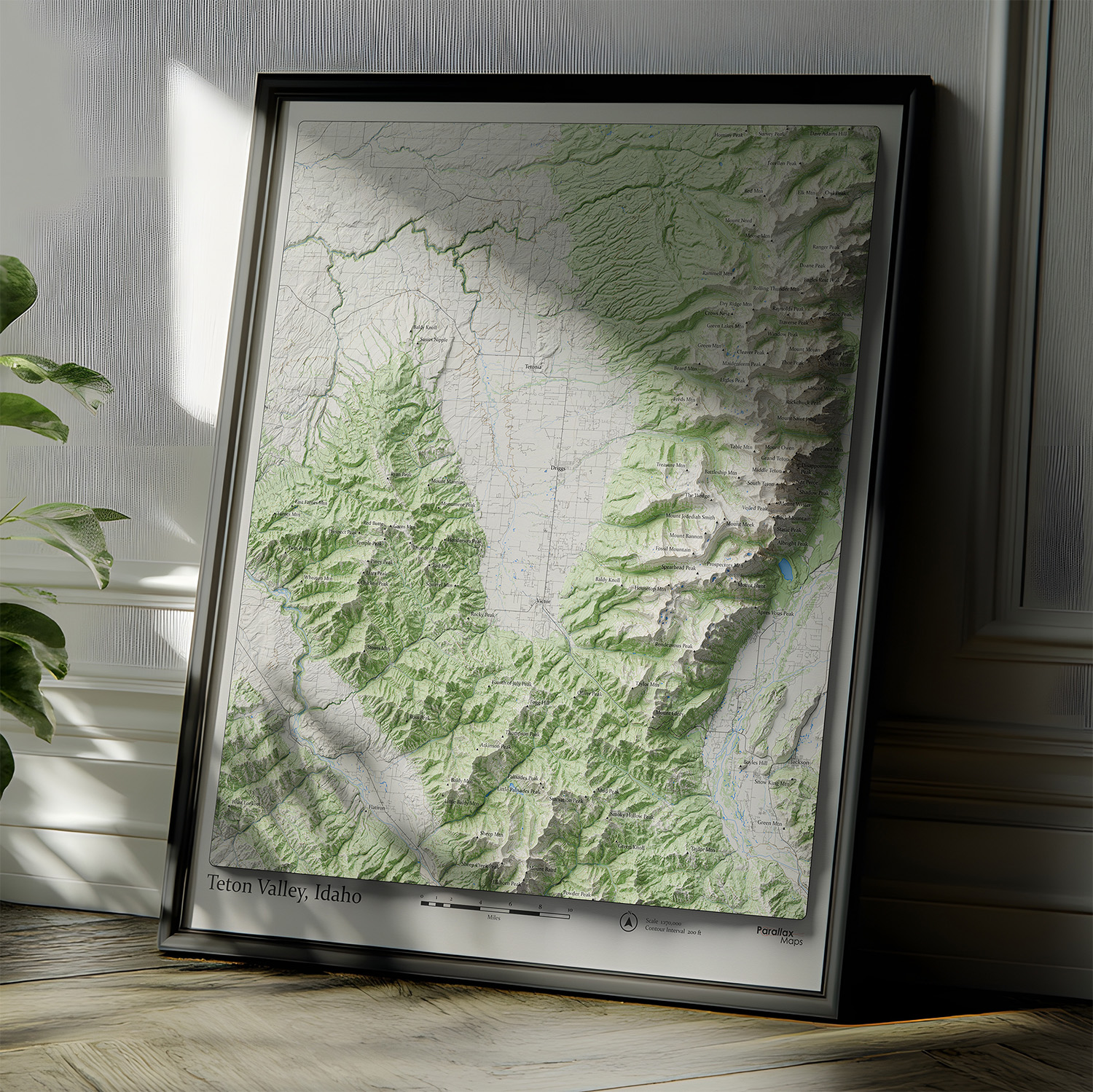
This one-of-a-kind map highlights the rugged topography of the Teton Valley near Driggs, Idaho. Gorgeous 3D-modeled hillshade adds a sense of depth to the landscape. Exquisitely detailed elevation contours, hydrological features, and forest cover.
Whether you’re a Teton Valley local, a frequent visitor, or simply someone who feels drawn to the wide open landscapes of the American West, this map is a powerful connection to place. It’s perfect for display in a home, mountain cabin, office, Airbnb, or creative studio.
Designed and printed in Colorado, our maps are produced using premium giclée inks on museum-grade paper for exceptional sharpness, depth, and long-lasting color. The result is an heirloom-quality art print that showcases every contour, ridgeline, and mountain peak with extraordinary precision, clarity, and depth.
Also, check out our Grand Teton National Park Map | 1948 edition, and Driggs and Jackson, WY Map | 1955 Edition
We use cookies to improve your experience on our site. By using our site, you consent to cookies.
Manage your cookie preferences below:
Essential cookies enable basic functions and are necessary for the proper function of the website.
These cookies are needed for adding comments on this website.
Statistics cookies collect information anonymously. This information helps us understand how visitors use our website.
Google Analytics is a powerful tool that tracks and analyzes website traffic for informed marketing decisions.
Service URL: policies.google.com (opens in a new window)
SourceBuster is used by WooCommerce for order attribution based on user source.