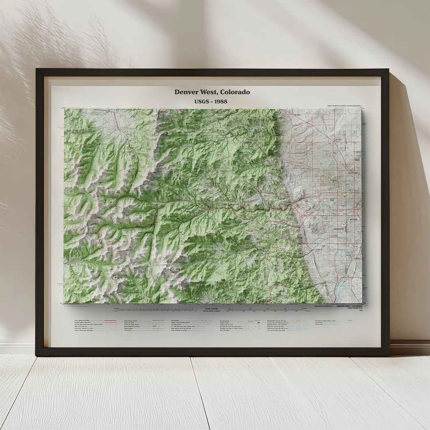
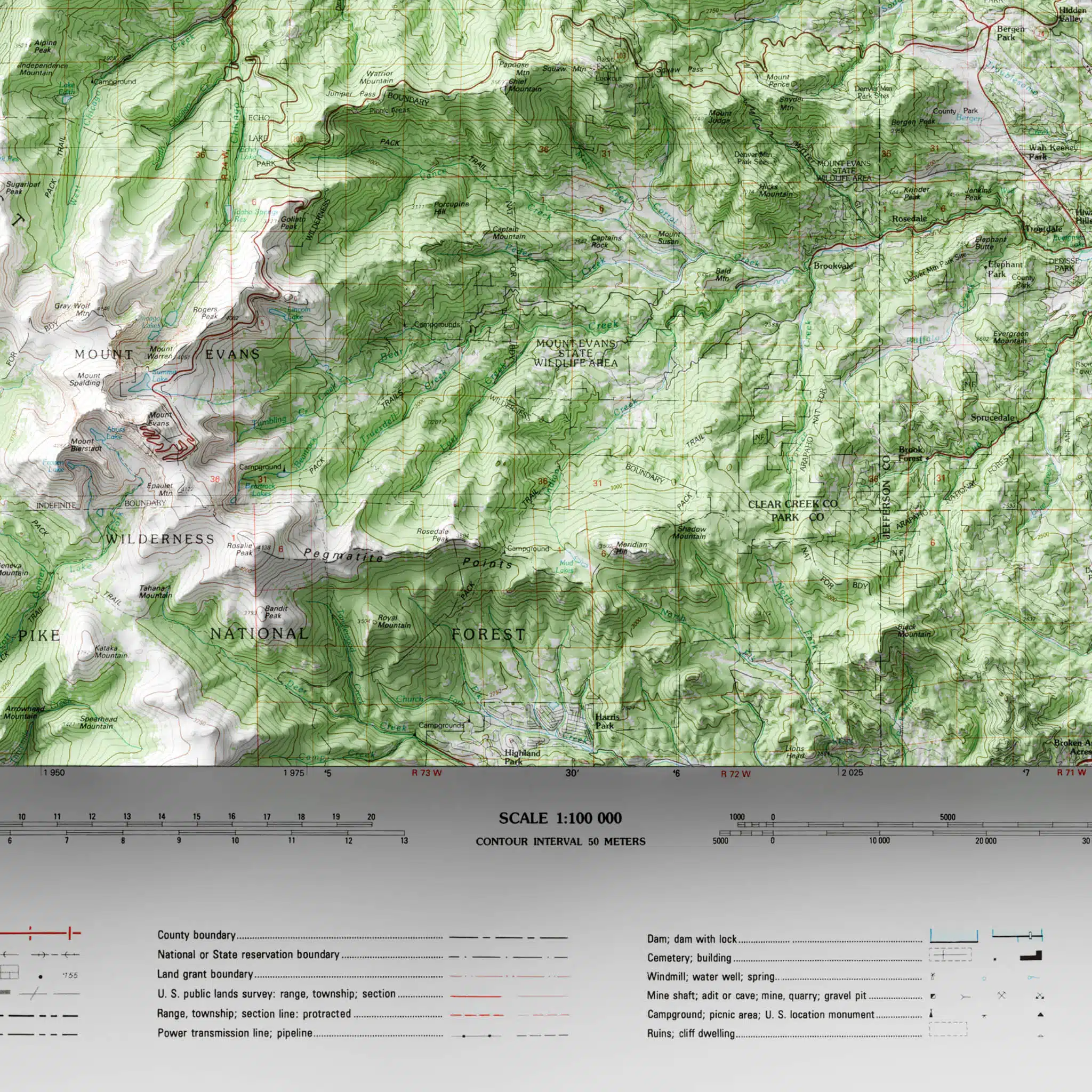
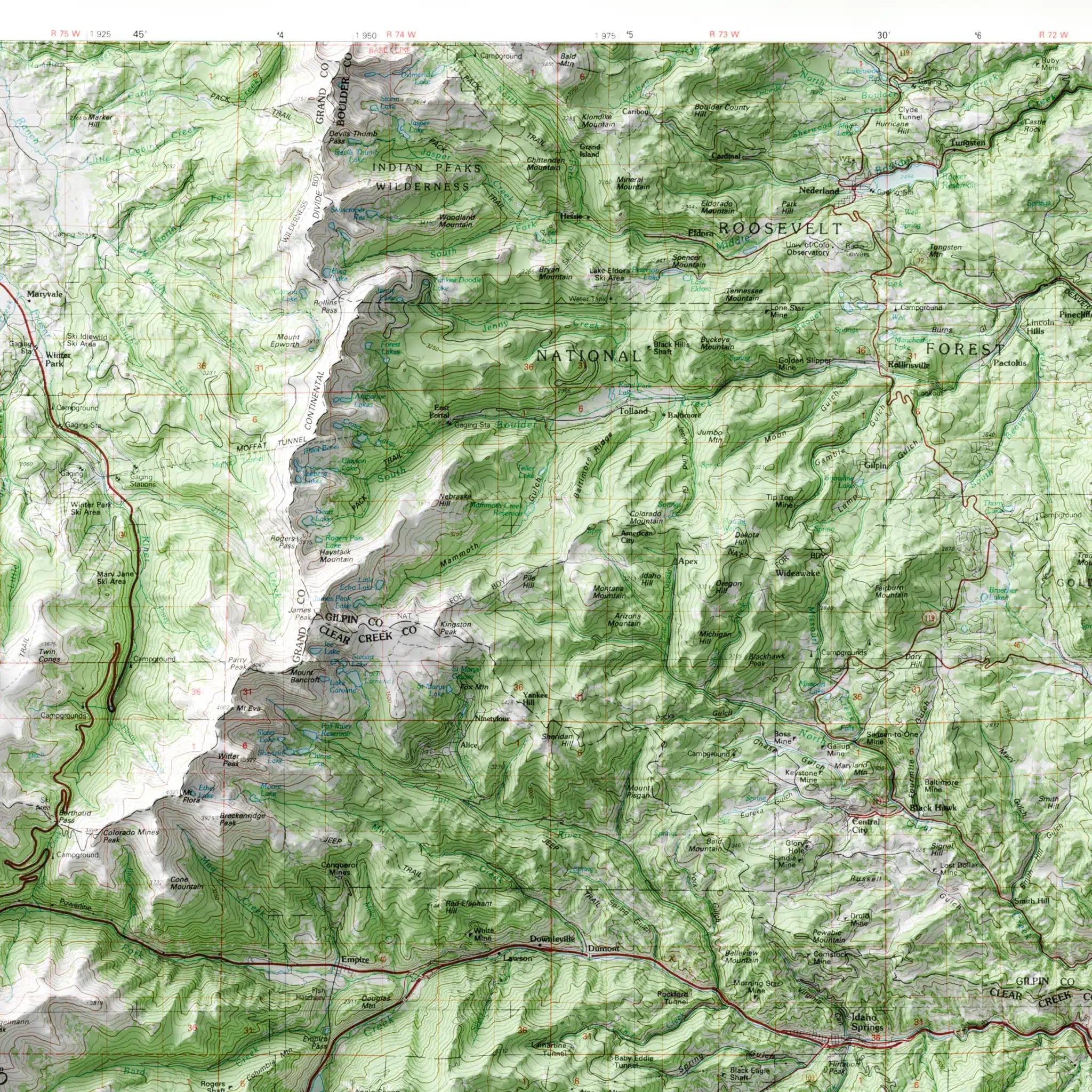
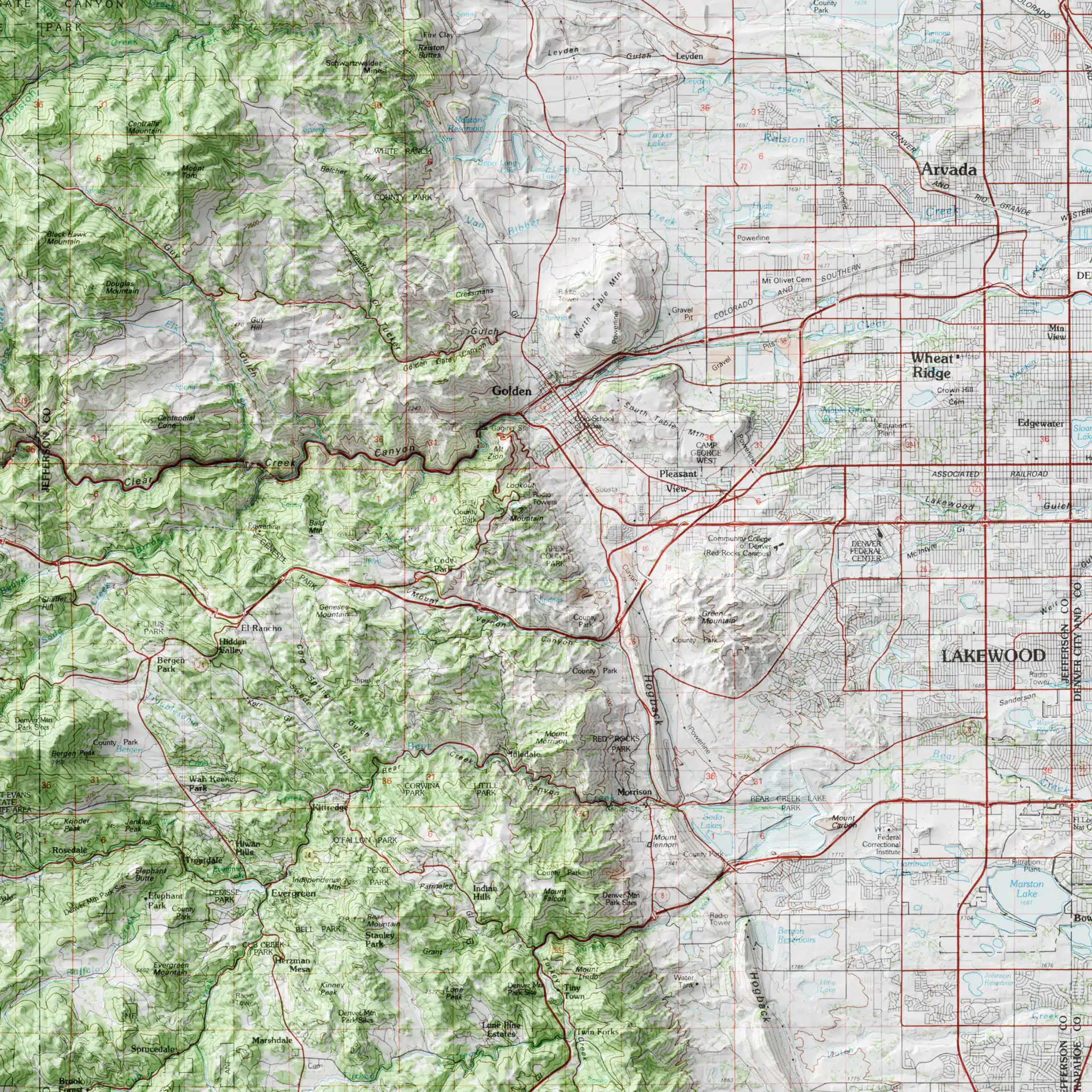
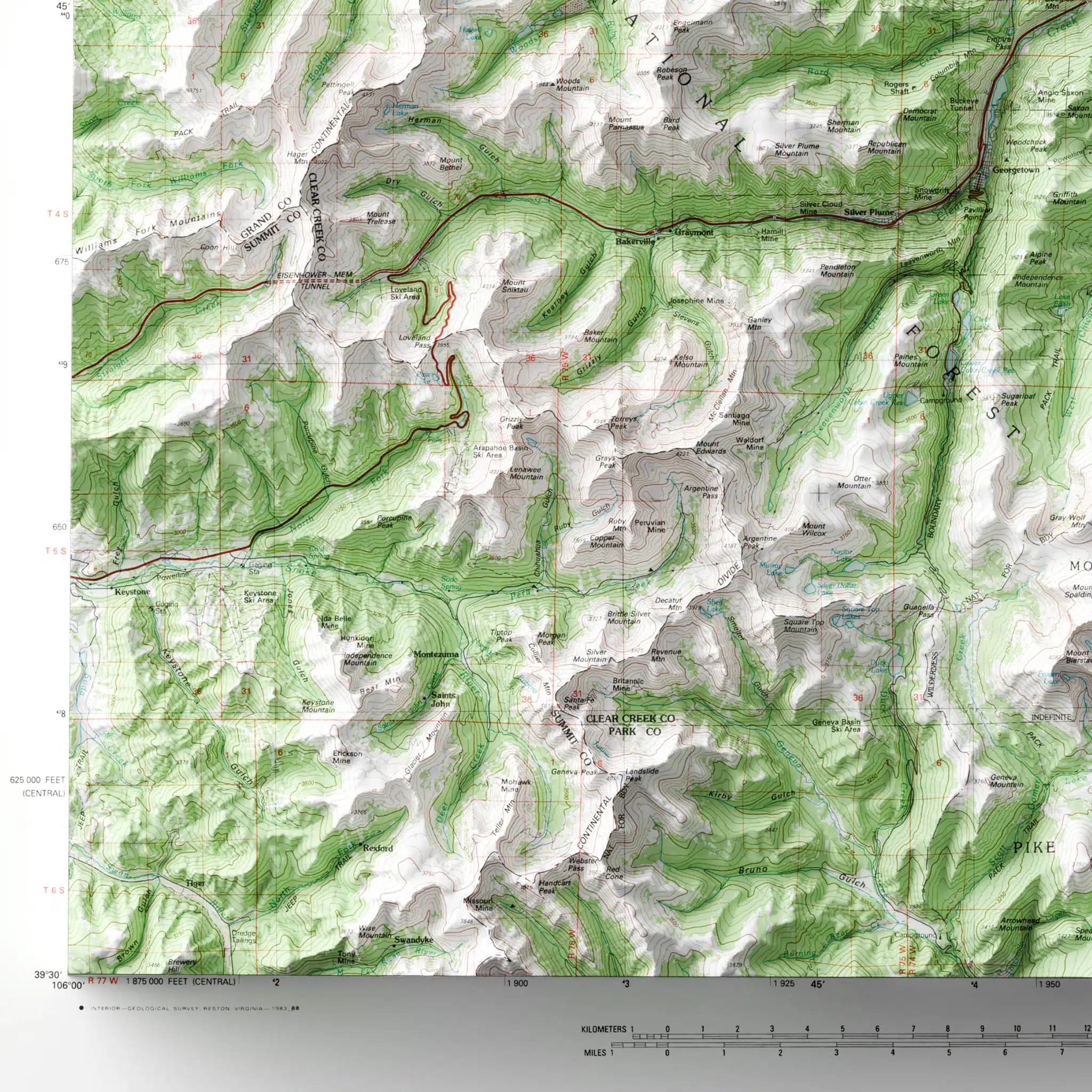
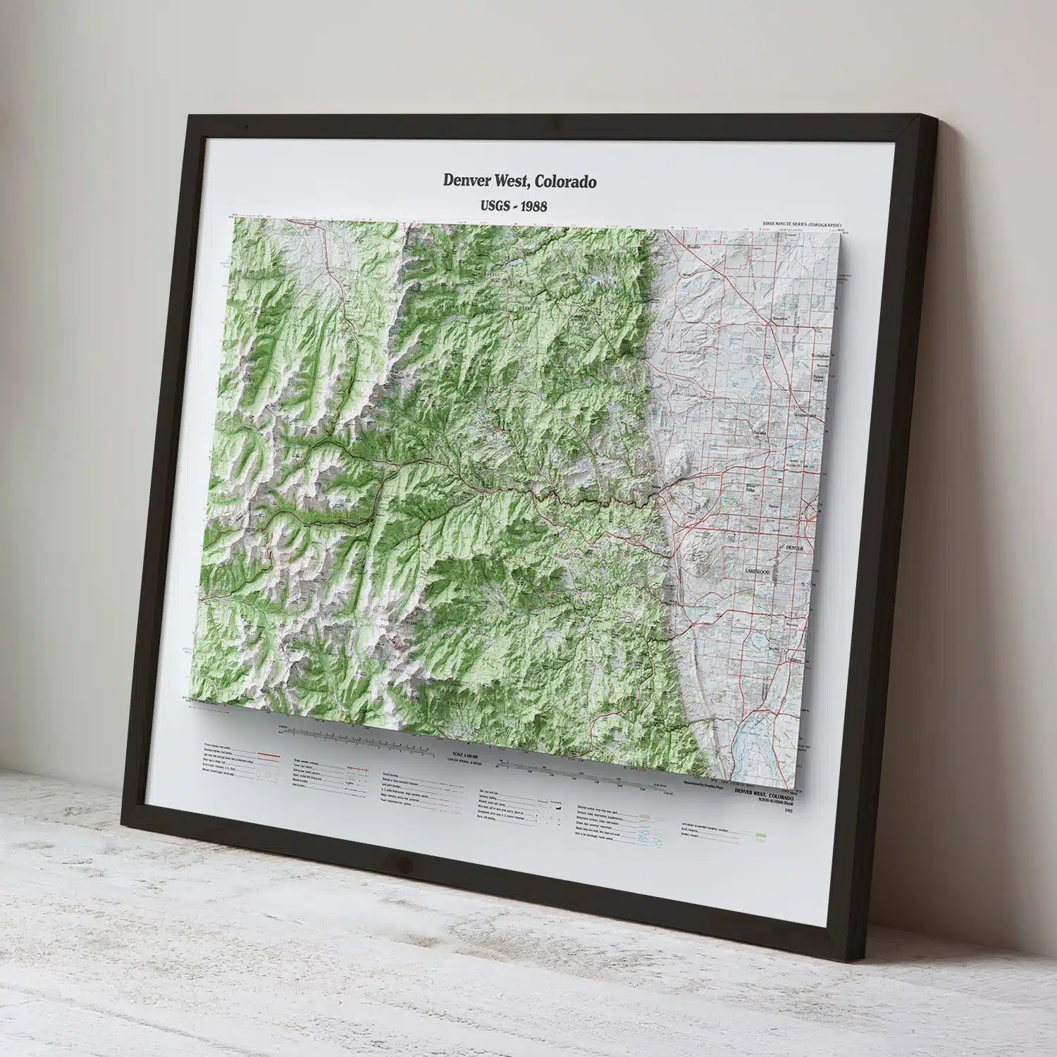
Stunning Vintage Denver Colorado map circa 1988, carefully restored and reimagined with modern cartographic techniques.
$39.00 – $89.00Price range: $39.00 through $89.00
Bring the Denver area mountains into your home with this beautiful Vintage Denver Colorado Map. Originally published by the USGS in 1988, this map of Denver and surrounding area has been carefully restored and reimagined with modern cartographic techniques. Using contemporary digital elevation models and 3D-modeling software, the rugged terrain has been brought to life. Exquisitely detailed, this map shows mountain peaks, canyons, lakes, rivers, roads, and towns as they existed in 1988.
Designed and printed in Colorado, our maps are produced using premium giclée inks on museum-grade paper for exceptional sharpness, depth, and long-lasting color. The result is an heirloom-quality art print that showcases every contour, ridgeline, and mountain peak with extraordinary precision, clarity, and depth.
Designed for map lovers, collectors, and front range adventurers, this piece blends historic charm, geographic accuracy, and artistic elegance, making it ideal for home offices, living rooms, and mountain cabins. A perfect gift for the discerning Colorado adventurer!
We use cookies to improve your experience on our site. By using our site, you consent to cookies.
Manage your cookie preferences below:
Essential cookies enable basic functions and are necessary for the proper function of the website.
These cookies are needed for adding comments on this website.
Statistics cookies collect information anonymously. This information helps us understand how visitors use our website.
Google Analytics is a powerful tool that tracks and analyzes website traffic for informed marketing decisions.
Service URL: policies.google.com (opens in a new window)
SourceBuster is used by WooCommerce for order attribution based on user source.