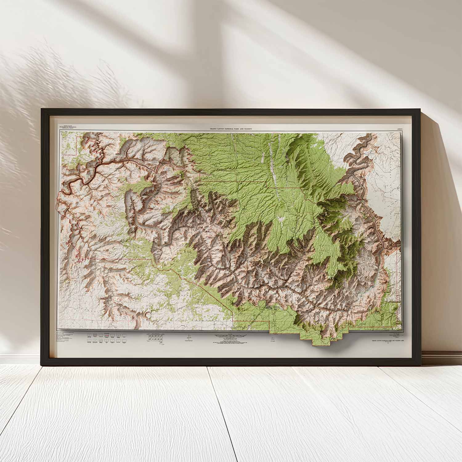
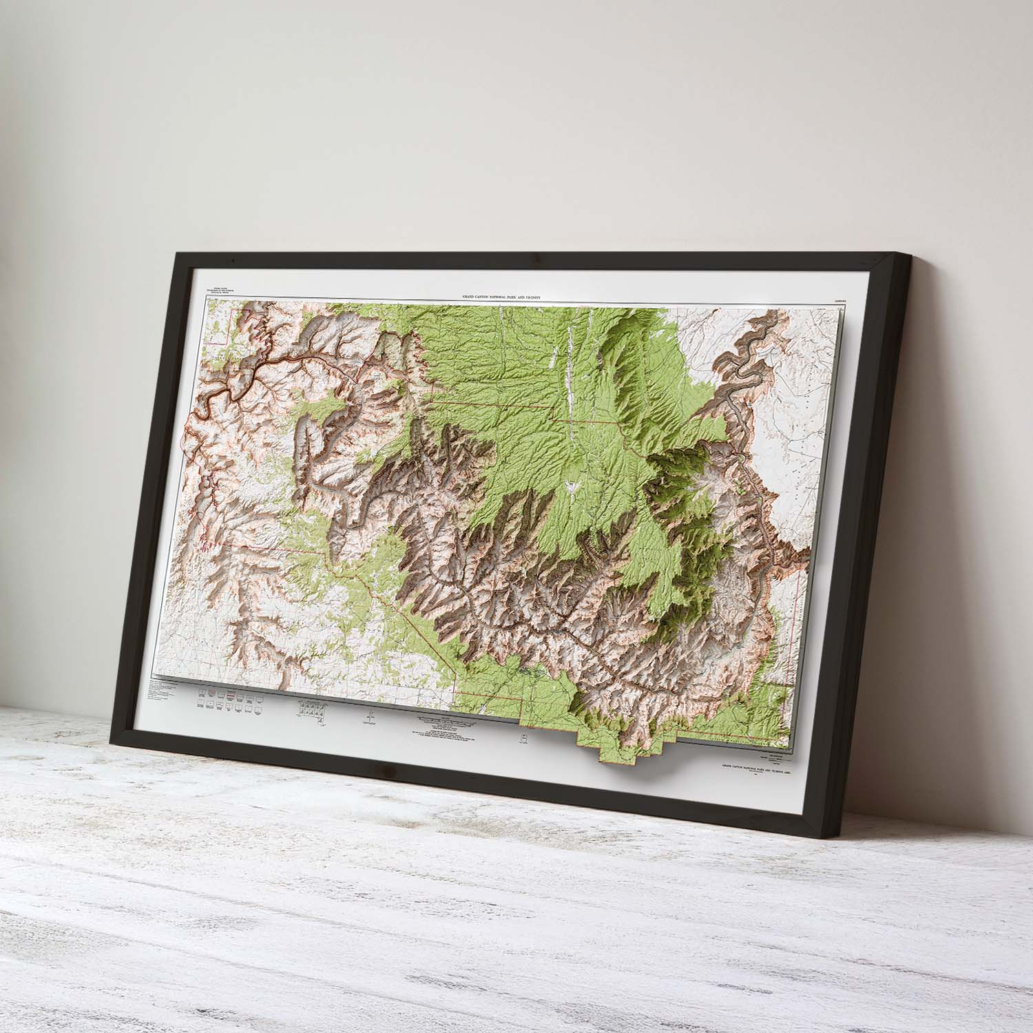
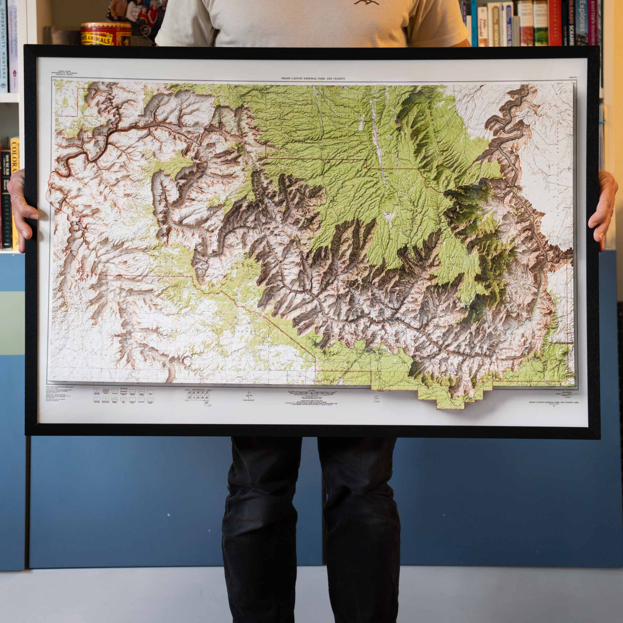
Stunning vintage map of Grand Canyon National Park, meticulously restored and enhanced with modern cartographic techniques.
$69.00 – $159.00Price range: $69.00 through $159.00
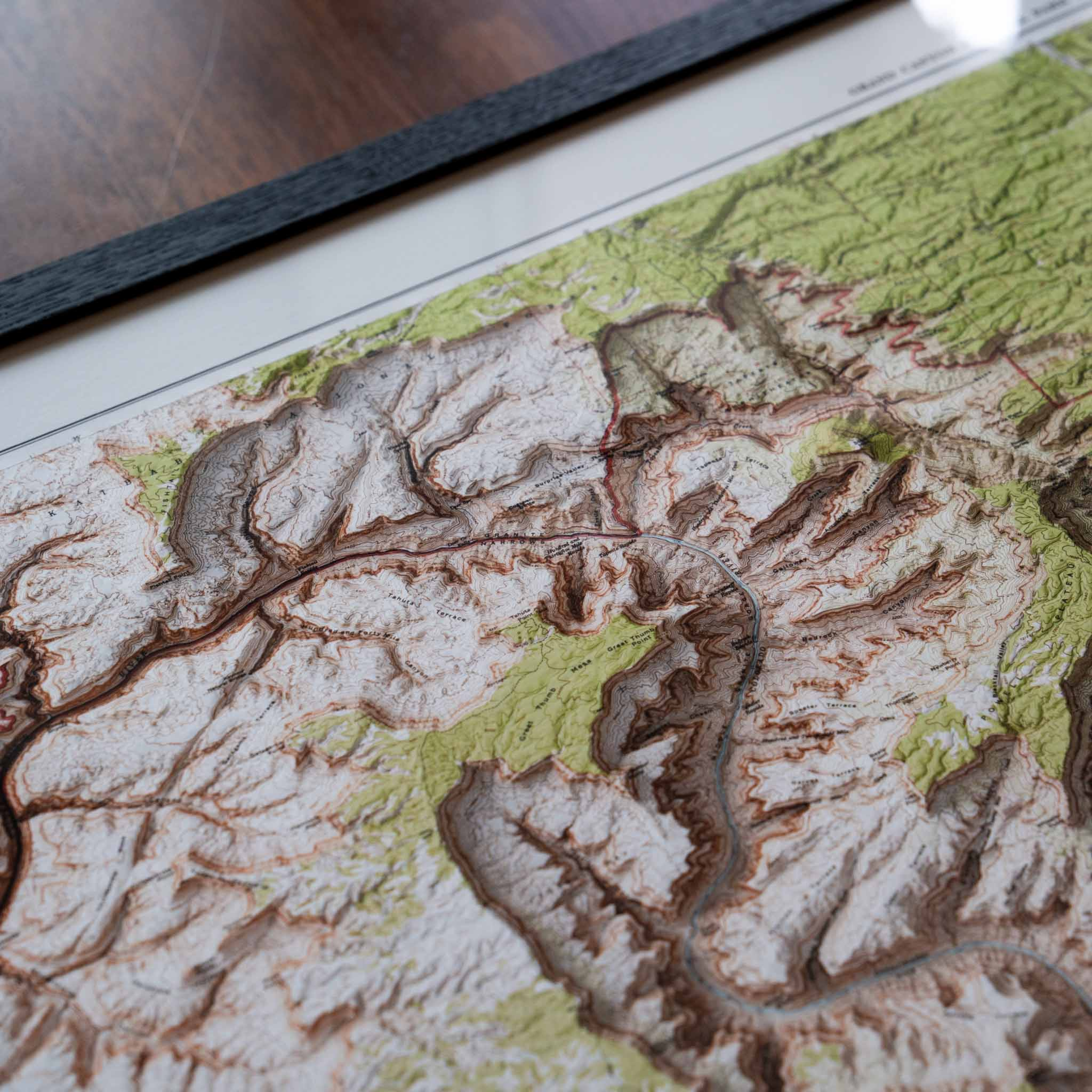
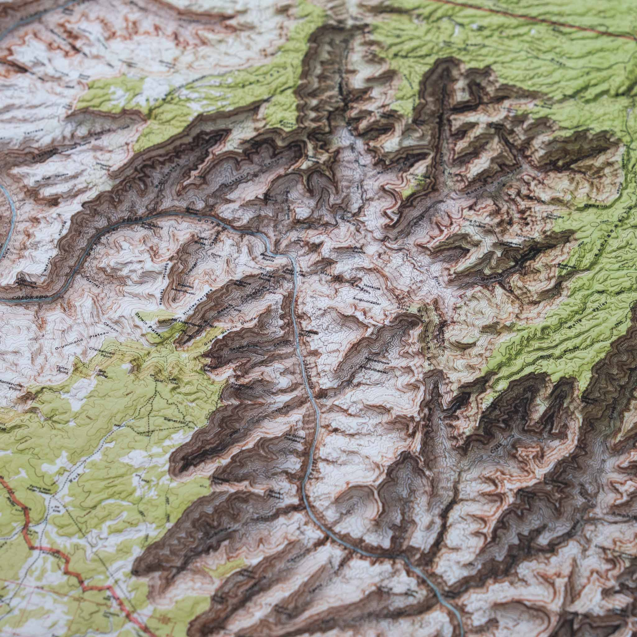
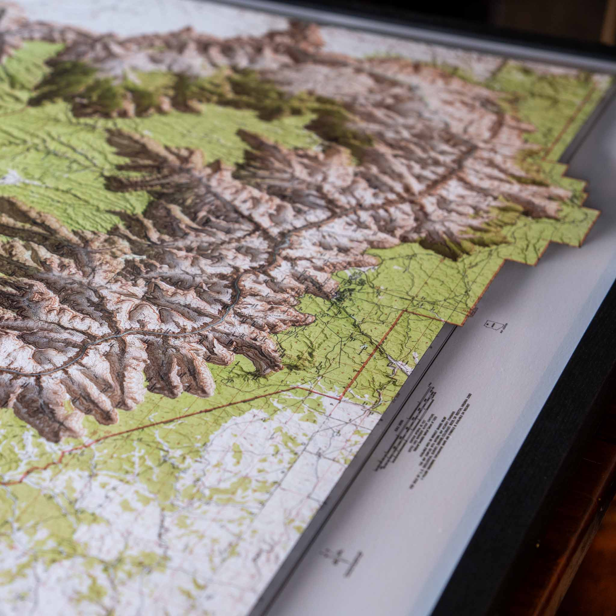
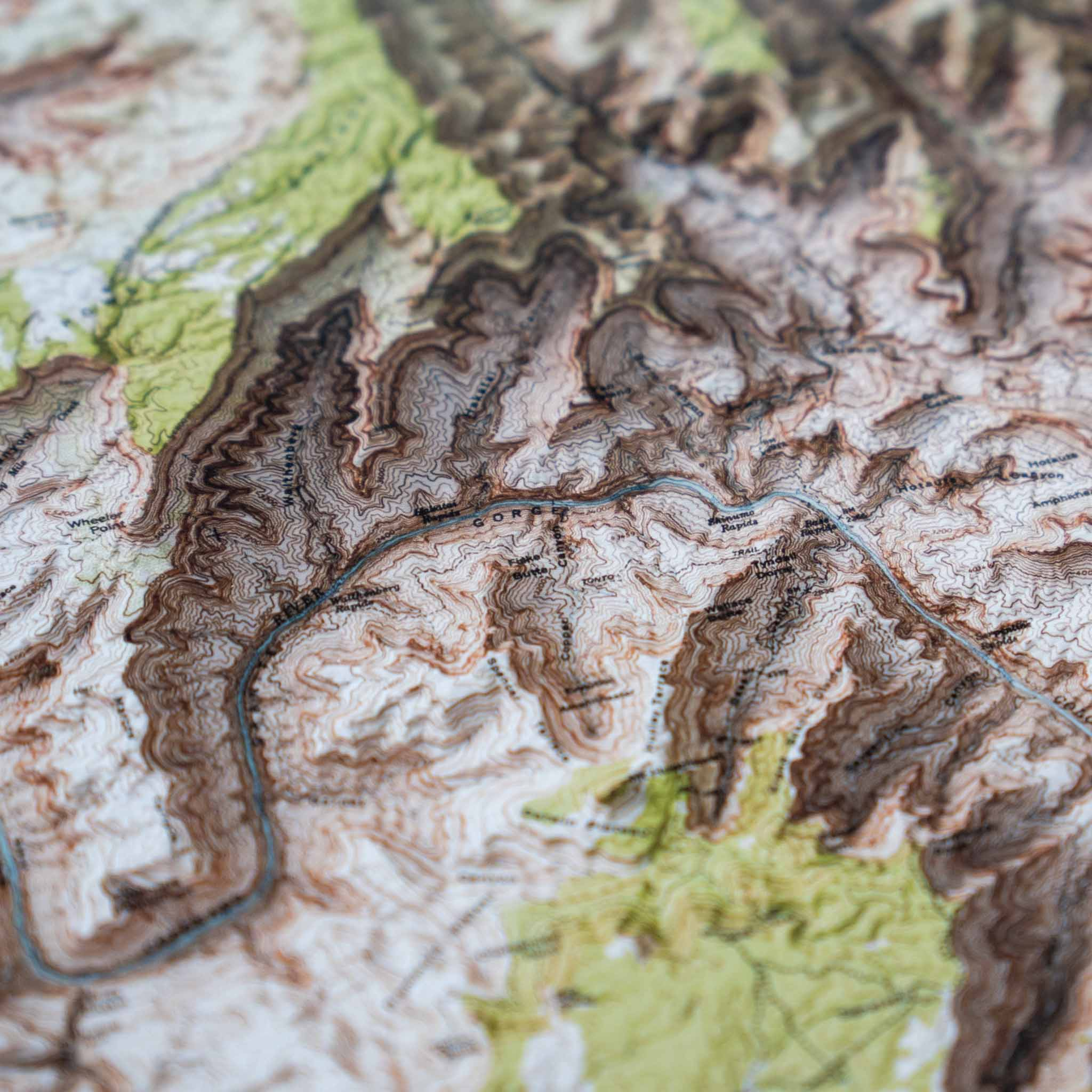
This stunning vintage map of Grand Canyon National Park brings the rugged beauty of the Grand Canyon to your walls. Meticulously restored from a 1962 original USGS map, every detail has been carefully preserved and enhanced with modern cartographic techniques. Using high-resolution elevation data and advanced 3D-modeling processes, the unique terrain of the Grand Canyon has been brought to life.
Perfect for river runners, backpackers, history buffs, map collectors, and all lovers of the Grand Canyon, this museum-quality map print elevates any space.
Why Grand Canyon lovers and adventurers choose this print:
Whether you’ve hiked the Bright Angel Trail, run the Colorado River, or simply revere the canyon from afar, this Grand Canyon map print is a timeless tribute to the grandest of canyons.
Please note this is not a 3D print but rather a traditional print that gives the impression of lifting off the page.
Order today and bring home a piece of history — beautifully restored, magnificently displayed.
We use cookies to improve your experience on our site. By using our site, you consent to cookies.
Manage your cookie preferences below:
Essential cookies enable basic functions and are necessary for the proper function of the website.
These cookies are needed for adding comments on this website.
Statistics cookies collect information anonymously. This information helps us understand how visitors use our website.
Google Analytics is a powerful tool that tracks and analyzes website traffic for informed marketing decisions.
Service URL: policies.google.com (opens in a new window)
SourceBuster is used by WooCommerce for order attribution based on user source.