
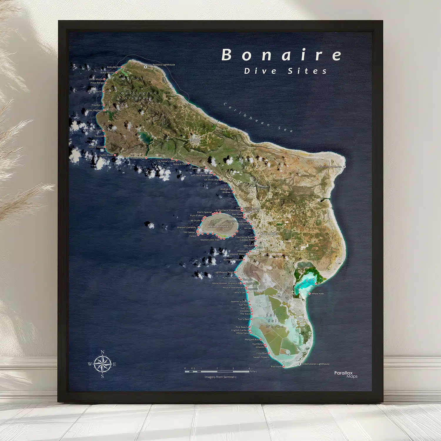
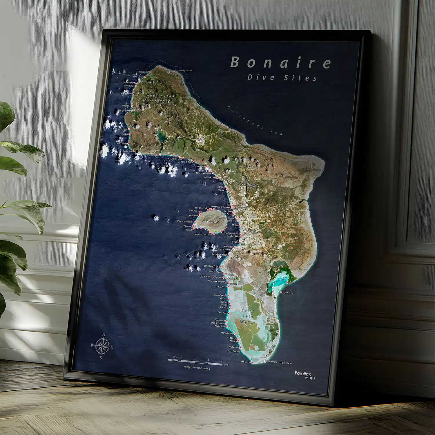
Explore the legendary Bonaire dive sites with this premium Bonaire Dive Site Map – perfect wall art for divers, travelers, and ocean lovers. Plan adventures, relive dives, and bring the island’s stunning beauty into your home!
$49.00 – $179.00Price range: $49.00 through $179.00
About the Bonaire Dive Sites Map
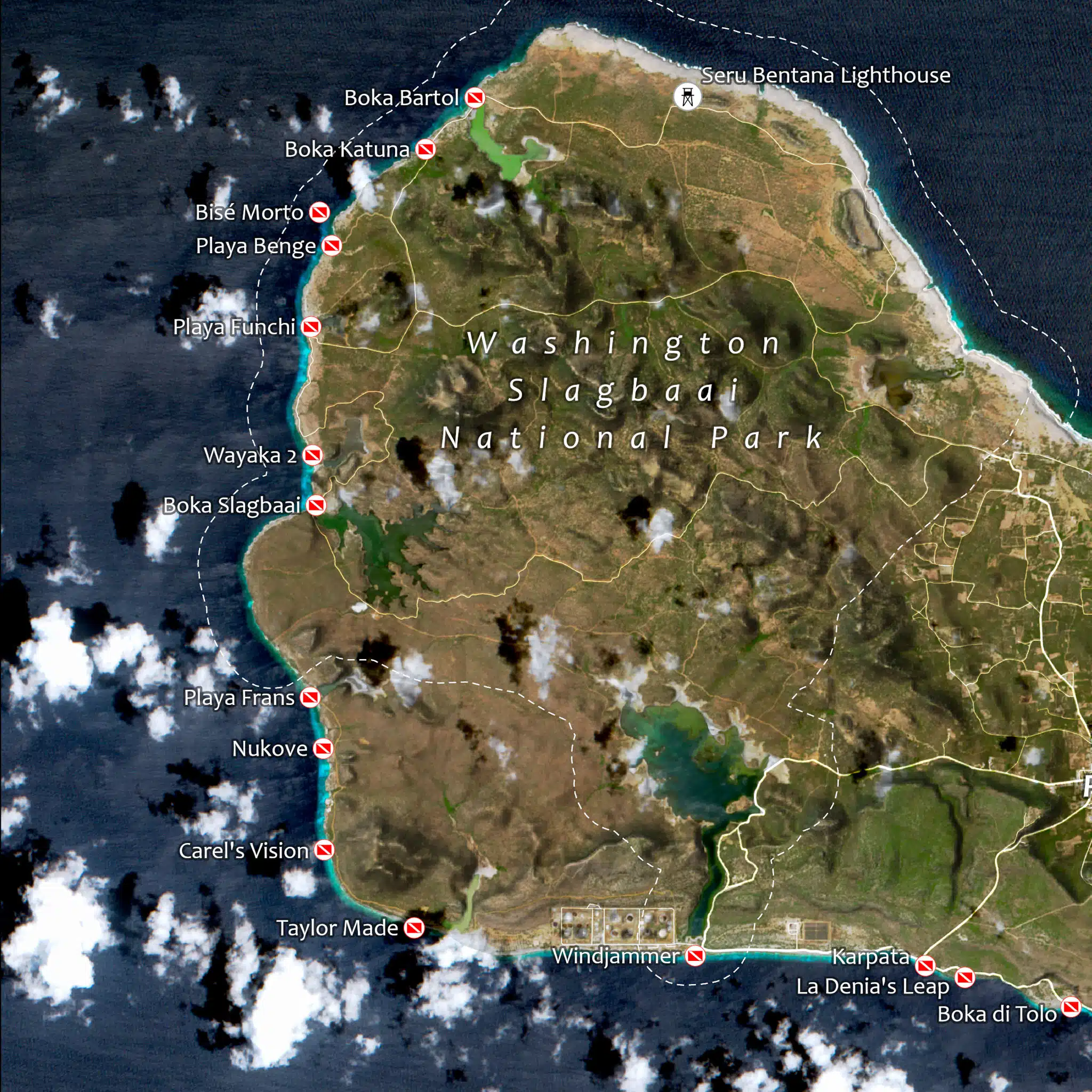
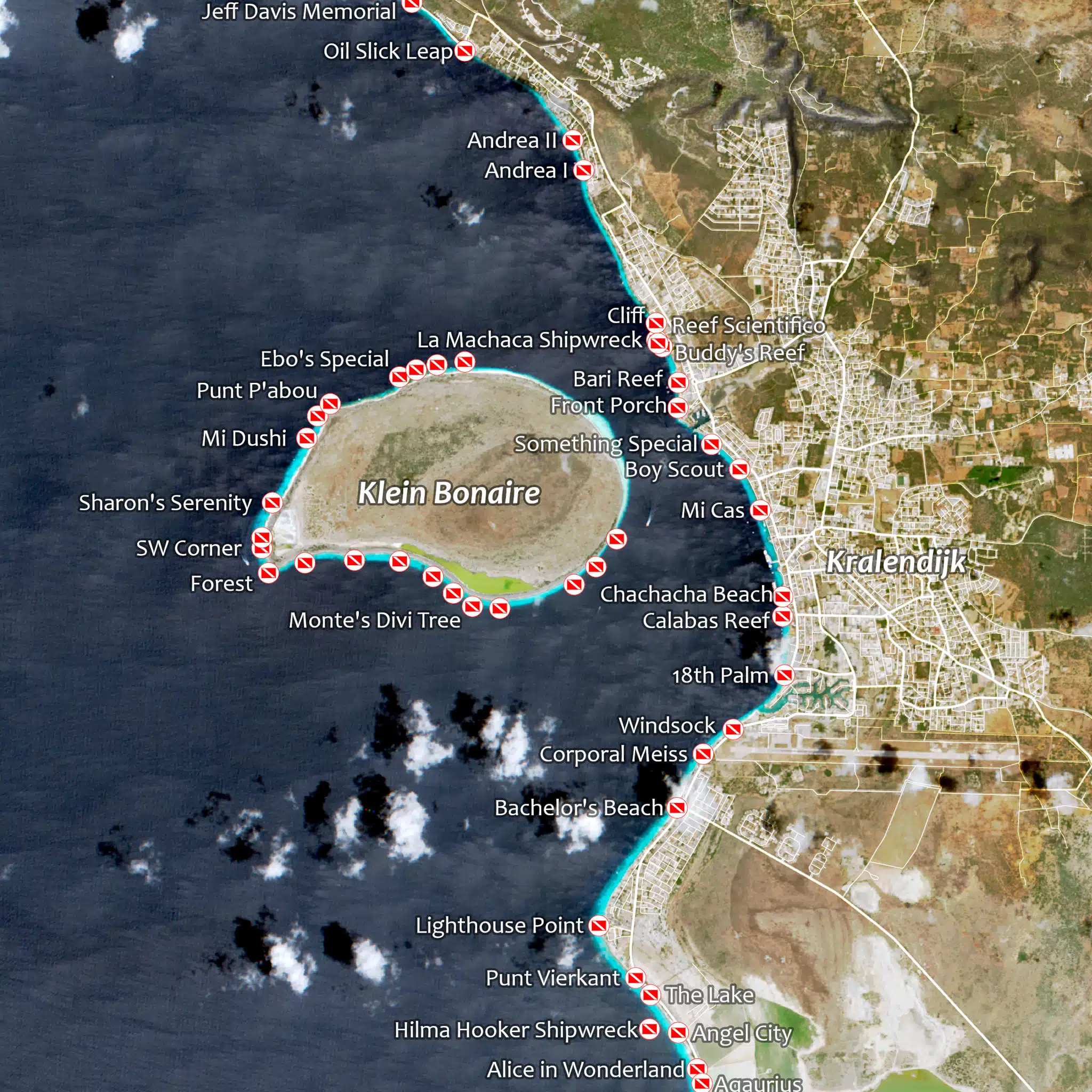
Bonaire is consistently ranked among the top shore-diving destinations on Earth, and this Bonaire Dive Sites Map is built specifically for the scuba divers and snorkelers who know why. Stunning satellite imagery has been transformed into a striking piece of wall art. This map clearly labels the island’s legendary dive sites – Windjammer, 1000 Steps, La Machaca Shipwreck, Lighthouse Point, Salt Pier, and dozens more – giving you a complete visual reference of this one-of-a-kind coastal paradise that makes Bonaire a bucket-list destination for underwater explorers.
This isn’t a generic tourist map. It’s a purpose-built dive site map of Bonaire, designed for people who plan their vacations around dive logs and bottom time.
What’s Depicted on This Map
This Bonaire scuba diving map combines high-resolution satellite imagery with carefully labeled dive site markers covering the island’s renowned western coastline and surrounding waters. Vibrant ocean blues trace the drop-offs and reef structures just offshore, while the island’s interior reveals deep greens of forested terrain alongside the unmistakable white-and-pink hues of the solar salt works in the south, one of Bonaire’s most recognizable landmarks.
Every major named dive site is clearly labeled, including iconic shore-entry spots like Windjammer, 1000 Steps, Salt Pier, and Lighthouse Point, as well as the storied La Machaca Shipwreck. Whether you’re planning your next dive trip, logging sites you’ve already explored, or reliving a honeymoon spent diving Bonaire’s famous reefs, this map turns satellite imagery and geographic accuracy into something you’ll want to look at every day.
Print Quality & Materials
Every map is printed on premium photo paper using archival-quality giclée inks, the same standard used in fine art galleries and museums. Giclée printing produces exceptionally sharp linework, vibrant and accurate color reproduction, and prints that are certified to resist fading for decades.
Each print is individually produced in the USA, with attention to detail that makes the difference between something you hang on a wall and something you genuinely treasure.
Framed options are available in a black woodgrain frame with a plexiglass front and pre-installed hanging hardware, so your map arrives ready to display. Prefer to frame it yourself? The print-only option ships flat up to 16in x 20in and rolled in a sturdy shipping tube for larger sizes, arriving ready for any standard frame.
Perfect For
This Bonaire dive sites map makes a meaningful and distinctive gift for a wide range of people and occasions:
Available in two sizes – 16×20, and 24×30 inches – this print scales beautifully whether you’re hanging it in a study nook or making a statement above a sofa or desk.
Data Source & Methodology
This map is built from high-resolution satellite imagery of Bonaire (courtesy of Copernicus Sentinel-2), with named dive sites individually researched and labeled for accuracy. The result is a geographically precise, visually rich map purpose-built for the diving and snorkeling community, combining real-world satellite data with clean, legible cartographic design.
If you’ve been lucky enough to dive in Okinawa, we offer a dive site map for that location as well: Okinawa Dive Sites Map
We use cookies to improve your experience on our site. By using our site, you consent to cookies.
Manage your cookie preferences below:
Essential cookies enable basic functions and are necessary for the proper function of the website.
These cookies are needed for adding comments on this website.
Statistics cookies collect information anonymously. This information helps us understand how visitors use our website.
Google Analytics is a powerful tool that tracks and analyzes website traffic for informed marketing decisions.
Service URL: policies.google.com (opens in a new window)
SourceBuster is used by WooCommerce for order attribution based on user source.