
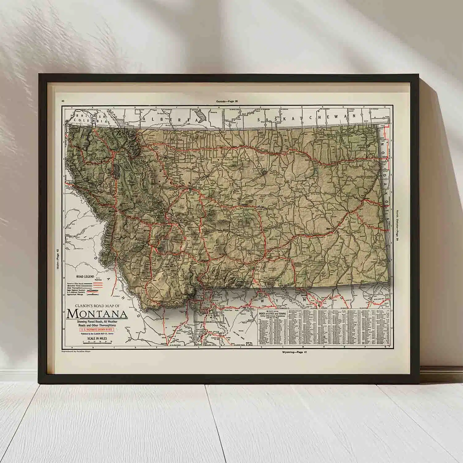
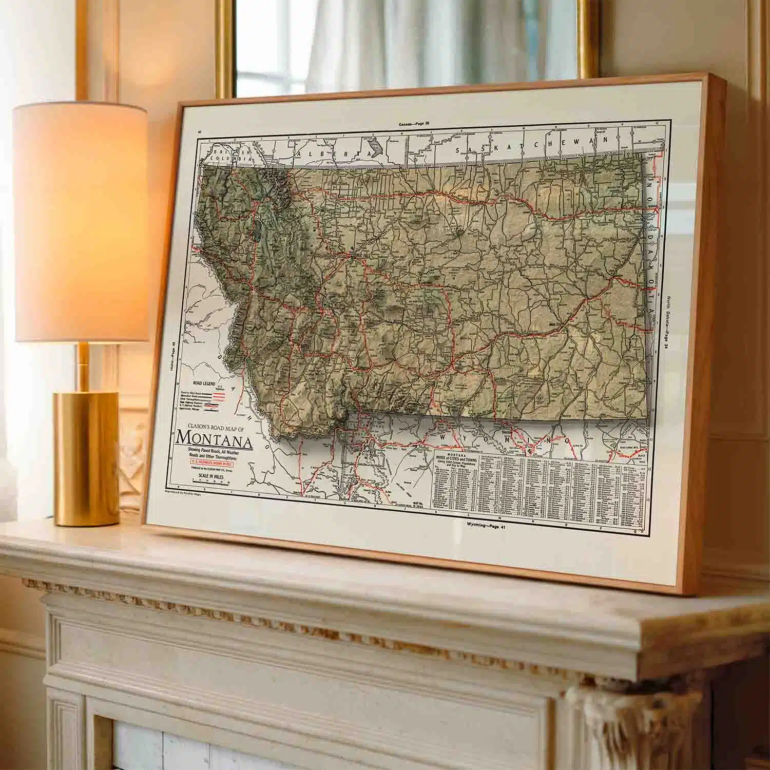
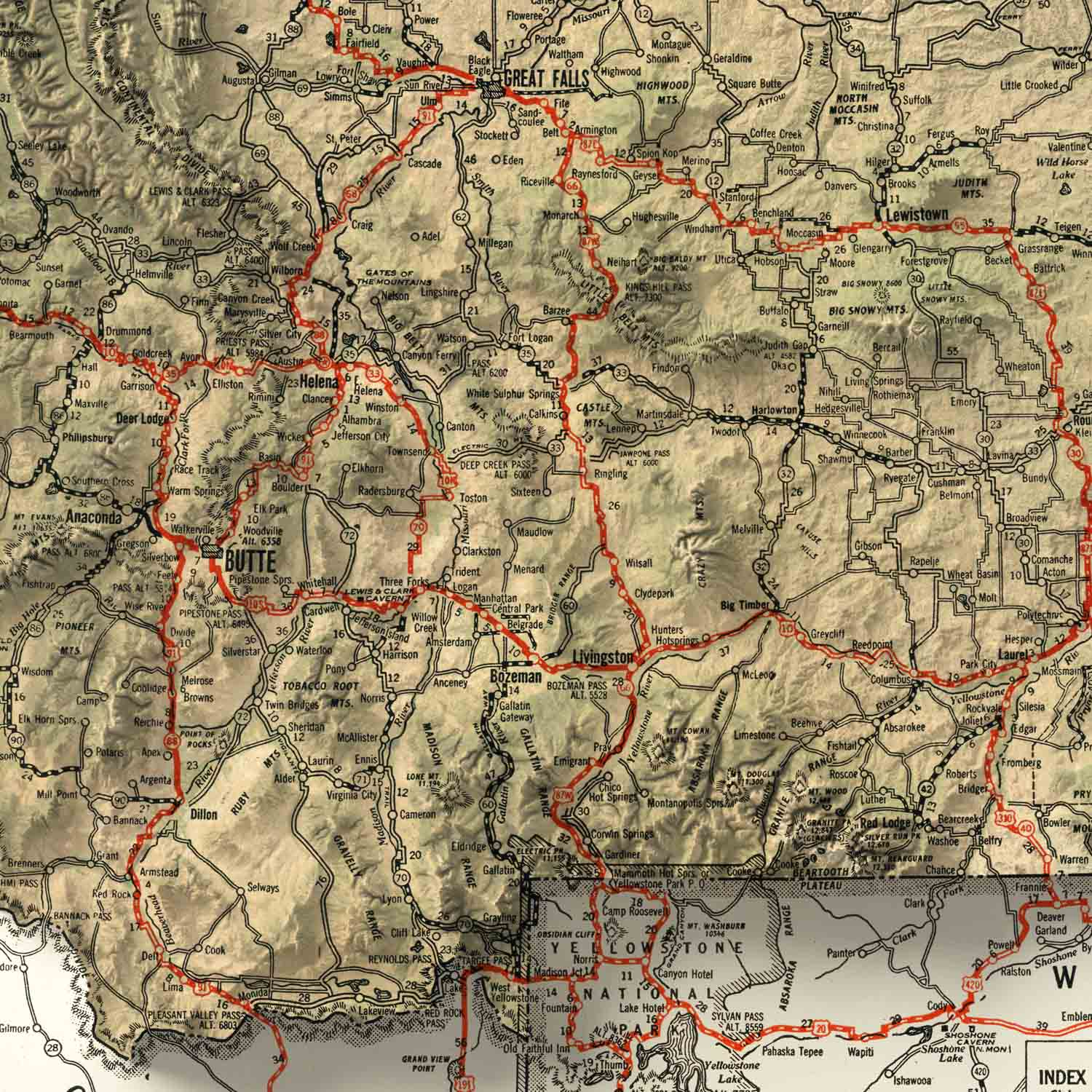

Explore this vintage 1931 Road Atlas Map of Montana – carefully restored and reimagined with modern cartographic techniques! A timeless Montana road map that elevates any space.
$49.00 – $179.00Price range: $49.00 through $179.00
About the Road Atlas Map of Montana | Vintage | Circa 1931
This Road Atlas Map of Montana is a carefully restored reproduction of “Clason’s Road Map of Montana,” originally published in 1931 by the Clason Map Company. George Samuel Clason, the Denver-based founder of the Clason Map Company, is widely credited with producing the first modern road atlas of the United States, and his annual Green Guides and touring atlases were the essential travel companions of the early automobile era. The 1931 edition holds a special place in that legacy: it was the final year Clason’s atlases were published before the company ceased operations during the Great Depression, making this map the last chapter of a remarkable run in American road mapping history.
Restored from the 1931 original and enhanced with modern high-resolution terrain shading and natural colors derived from satellite imagery, this Montana wall map transforms a piece of cartographic history into a visually stunning work of art that brings the Big Sky State’s dramatic landscape to life like no standard map print can.
What’s Depicted on This Map
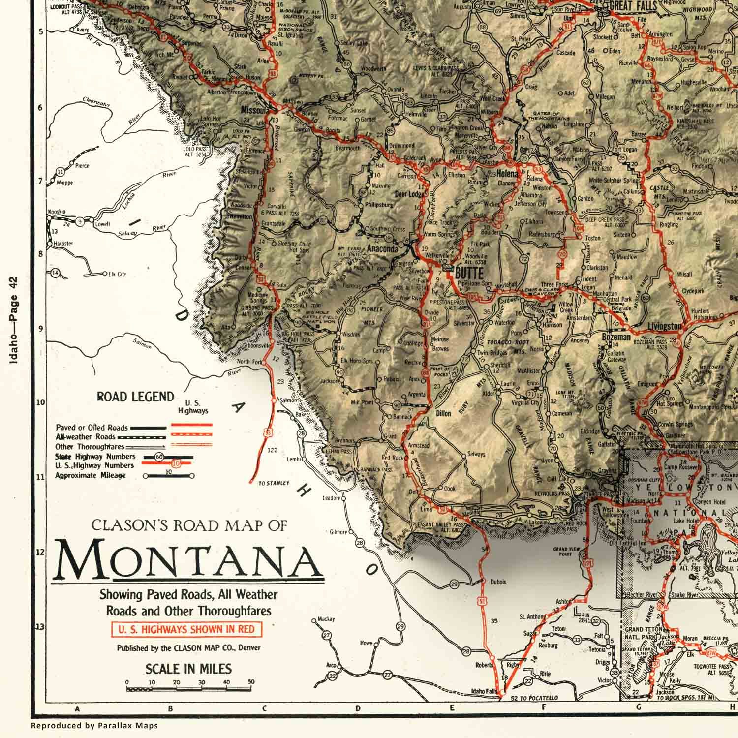
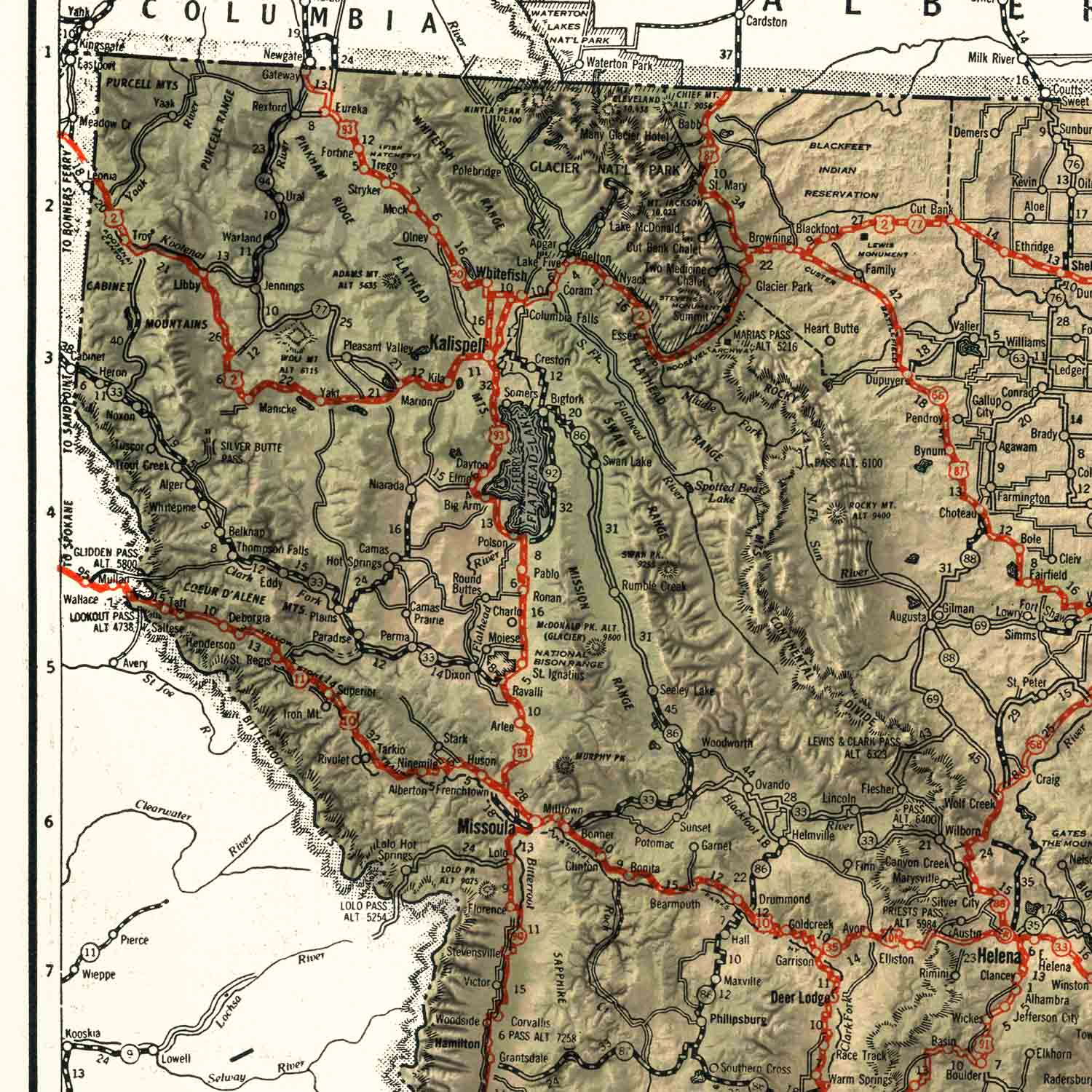
This vintage Montana road map preserves the distinctive detail of Clason’s commercial cartography at its finest: roads classified by surface and condition, railroad lines, county boundaries, towns and natural features rendered with the clarity and purpose that made Clason’s maps the gold standard of the early motoring age. The Missouri River headwaters, the Rocky Mountain Front, Glacier National Park, and the vast open country of the eastern plains are all captured as they appeared to a motorist in 1931 — before the interstate highway system, before the modern tourist infrastructure, and before the sprawling development that has since transformed much of the American West.
To bring this historic map into the present, we’ve added high-resolution terrain shading that gives Montana’s peaks, valleys, and river corridors a striking sense of depth and dimension – ridgelines and mountain ranges seem to lift off the page. Natural colors derived from satellite imagery gives finished piece a richness and realism that standard vintage reproductions simply can’t match.
Print Quality & Materials
Every map is printed on premium photo paper using archival-quality giclée inks, the same standard used in fine art galleries and museums. Giclée printing produces exceptionally sharp linework, vibrant and accurate color reproduction, and prints that are certified to resist fading for decades.
Each print is individually produced in the USA, with attention to detail that makes the difference between something you hang on a wall and something you genuinely treasure.
Framed options are available in a black woodgrain frame with a plexiglass front and pre-installed hanging hardware, so your map arrives ready to display. Prefer to frame it yourself? The print-only option ships flat for the 16×20 inch size and rolled in a sturdy shipping tube for the 24×30 inch size, arriving ready for any standard frame.
Perfect For
This vintage Montana road map print makes a meaningful and distinctive gift for a wide range of people and occasions:
Available in two sizes — 16×20 and 24×30 inches — this print works beautifully whether displayed in a cabin, a home office, or a living room.
Data Source & Methodology
This map is a careful restoration of “Clason’s Road Map of Montana,” originally published in 1931 by the Clason Map Company as part of their final touring atlas series. The original road network, place names, and cartographic detail have been preserved and carefully restored, while modern high-resolution terrain shading and satellite imagery have been integrated to bring Montana’s extraordinary landscape to life with depth, dimension, and color fidelity that honors both the historical source and the grandeur of the state it depicts.
*Original map obtained from the David Rumsey Map Collection
Check out our other vintage maps here: Vintage Map Collection
We use cookies to improve your experience on our site. By using our site, you consent to cookies.
Manage your cookie preferences below:
Essential cookies enable basic functions and are necessary for the proper function of the website.
These cookies are needed for adding comments on this website.
Required for the shopping cart and checkout to work, such as remembering the items in your cart.
Service URL: woocommerce.com (opens in a new window)
Our card payment processor. These cookies help detect and prevent fraud during checkout.
Service URL: stripe.com (opens in a new window)
Used to keep customers signed in to their account on our site.
Service URL: wordpress.org (opens in a new window)
Statistics cookies collect information anonymously. This information helps us understand how visitors use our website.
Google Analytics is a powerful tool that tracks and analyzes website traffic for informed marketing decisions.
Service URL: policies.google.com (opens in a new window)
SourceBuster is used by WooCommerce for order attribution based on user source.
Marketing cookies are used to follow visitors to websites. The intention is to show ads that are relevant and engaging to the individual user.
Google Ads measures which ad clicks lead to purchases (conversion tracking) and helps show relevant ads. Runs in Google Consent Mode, so no Ads cookies are set until marketing consent is given.
Service URL: policies.google.com (opens in a new window)
The Pinterest tag and Conversions API measure which Pinterest ads lead to visits and purchases on our store and help Pinterest show relevant ads.
Service URL: policy.pinterest.com (opens in a new window)
You can find more information in our Cookie Policy and .