
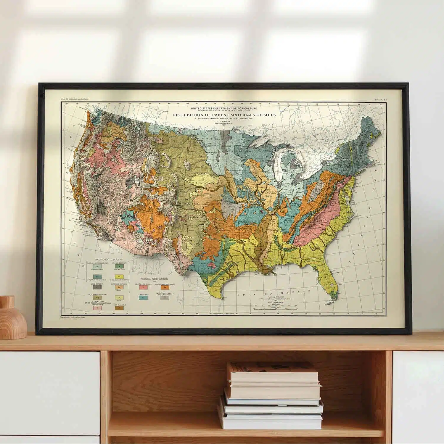

A faithfully restored 1931 USDA map showing the distribution of soils in the contiguous United States, enhanced with striking modern terrain shading.
$79.00 – $249.00Price range: $79.00 through $249.00
About the Vintage US Soils Map
Few historical maps capture the physical character of a continent quite like this one. This Vintage US Soils Map is a carefully restored reproduction of a 1931 original published by the U.S. Department of Agriculture, titled “Distribution of Parent Materials of Soils – Classified According to Process of Accumulation.” Nearly a century old, it remains one of the most distinctive and visually compelling soil maps ever produced, and this print brings it back to life with modern clarity and color fidelity.
The map covers the contiguous United States in full, revealing the geological forces – glaciers, ancient seas, lakes, wind, and rivers that shaped the ground beneath every region of the country.
What’s Depicted on This Map
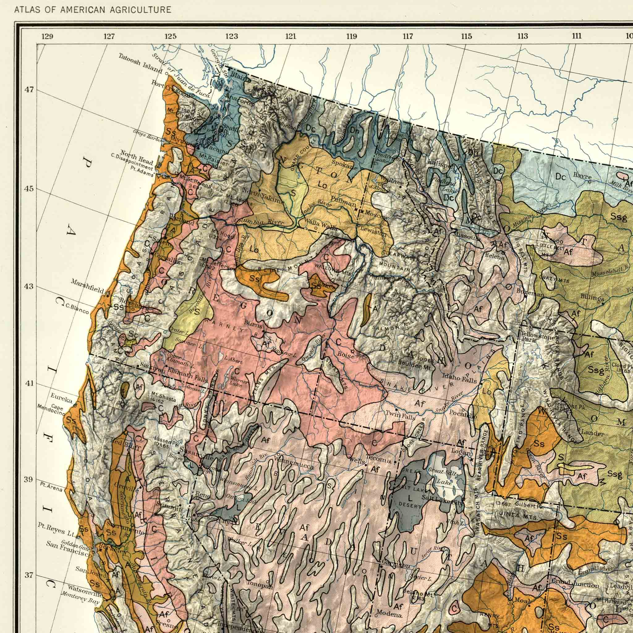
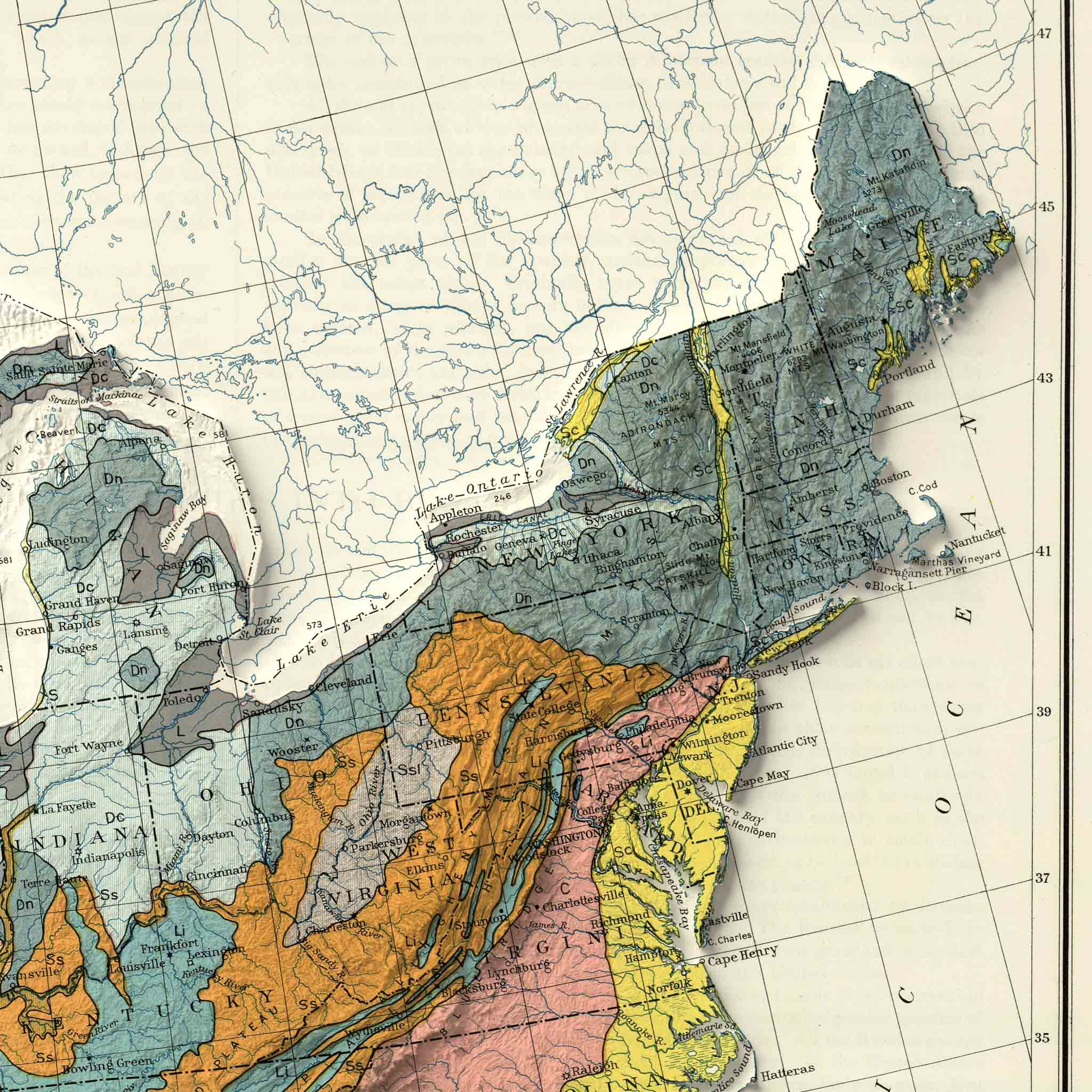
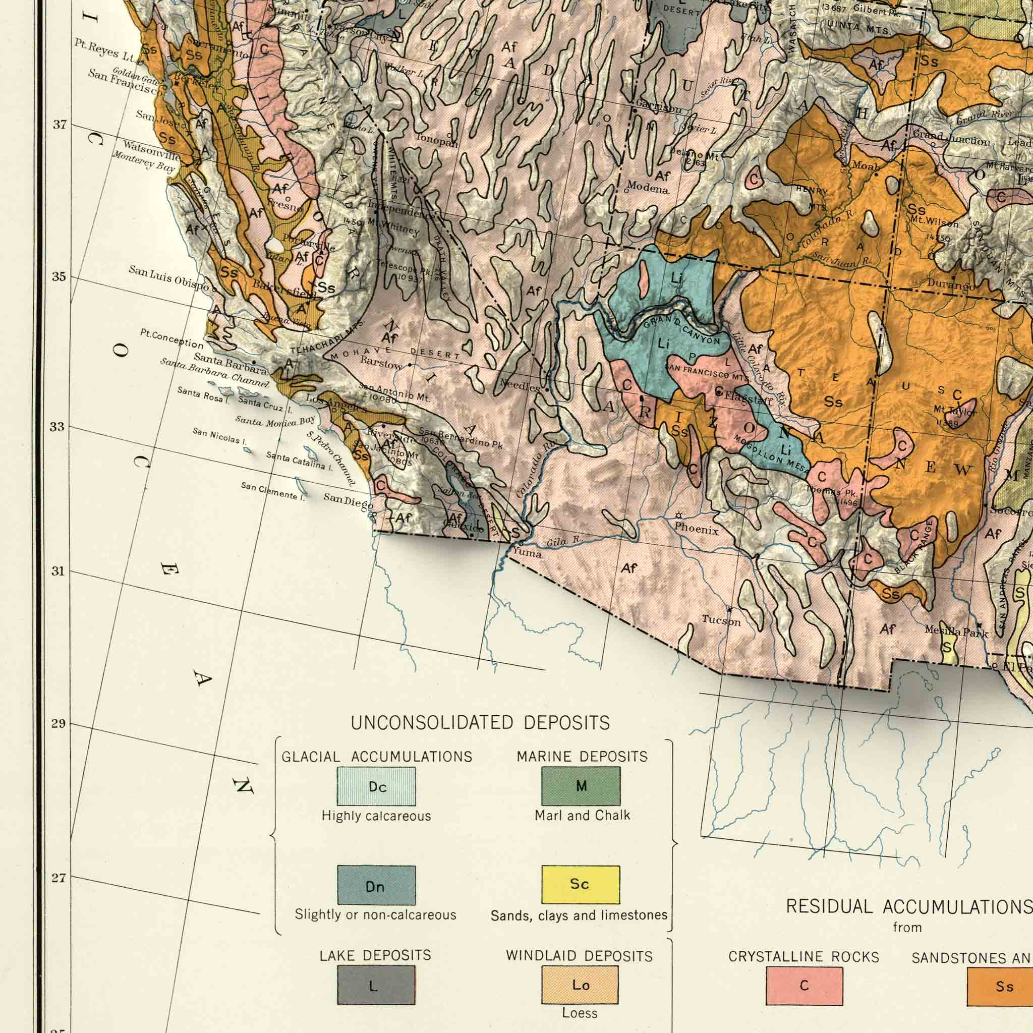
This vintage USDA soils map classifies the entire country by parent material: the geological process responsible for depositing or forming the soil in any given region. Glacial accumulation sweeps across the upper Midwest and Northeast, a direct legacy of the last ice age. Marine and lake deposits trace the outlines of ancient coastlines and inland seas long since vanished. Windlaid deposits, or loess, blanket portions of the Great Plains, while river alluvium follows the floodplains of the Mississippi and its tributaries — soil quite literally built by moving water over millennia.
Residual soils, formed in place from the slow weathering of sandstone, shale, and limestone bedrock, fill in the remainder of the picture, particularly across the Appalachians and the interior highlands. Together, these classifications form a portrait of the United States unlike any standard political or topographic map – one based not on borders or elevation, but on deep geological history.
To bring this historic data into the present, we’ve added high-resolution shaded relief terrain to the original soil classification data, giving the print a striking sense of depth and dimension. Mountain ranges and river valleys seem to lift off the page, grounding nearly a century of soil science in a landscape you can see and feel.
Print Quality & Materials
Every map is printed on premium photo paper using archival-quality giclée inks, the same standard used in fine art galleries and museums. Giclée printing produces exceptionally sharp linework, vibrant and accurate color reproduction, and prints that are certified to resist fading for decades.
Each print is individually produced in the USA, with attention to detail that makes the difference between something you hang on a wall and something you genuinely treasure.
Framed options are available in a black woodgrain frame with a plexiglass front and pre-installed hanging hardware, so your map arrives ready to display.
Perfect For
This vintage US soils map makes a meaningful and distinctive gift for a wide range of people and occasions:
Data Source & Methodology
This map is a careful restoration of a 1931 original published by the U.S. Department of Agriculture, “Distribution of Parent Materials of Soils – Classified According to Process of Accumulation.” The original soil classifications including glacial, marine, and alluvial deposits, as well as residual soils derived from sandstone, shale, and limestone have been preserved and enhanced with modern high-resolution shaded relief terrain, producing a print that honors the integrity of historic USDA soil science while delivering the visual impact of a contemporary fine art map. The original map in digital format was made available through the David Rumsey Map Collection.
We use cookies to improve your experience on our site. By using our site, you consent to cookies.
Manage your cookie preferences below:
Essential cookies enable basic functions and are necessary for the proper function of the website.
These cookies are needed for adding comments on this website.
Required for the shopping cart and checkout to work, such as remembering the items in your cart.
Service URL: woocommerce.com (opens in a new window)
Our card payment processor. These cookies help detect and prevent fraud during checkout.
Service URL: stripe.com (opens in a new window)
Used to keep customers signed in to their account on our site.
Service URL: wordpress.org (opens in a new window)
Statistics cookies collect information anonymously. This information helps us understand how visitors use our website.
Google Analytics is a powerful tool that tracks and analyzes website traffic for informed marketing decisions.
Service URL: policies.google.com (opens in a new window)
SourceBuster is used by WooCommerce for order attribution based on user source.
Marketing cookies are used to follow visitors to websites. The intention is to show ads that are relevant and engaging to the individual user.
Google Ads measures which ad clicks lead to purchases (conversion tracking) and helps show relevant ads. Runs in Google Consent Mode, so no Ads cookies are set until marketing consent is given.
Service URL: policies.google.com (opens in a new window)
The Pinterest tag and Conversions API measure which Pinterest ads lead to visits and purchases on our store and help Pinterest show relevant ads.
Service URL: policy.pinterest.com (opens in a new window)
You can find more information in our Cookie Policy and .